Paliseul
Palijhoû (Walloon) | |
|---|---|
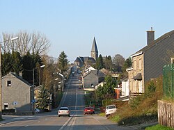 Bouillon Street | |
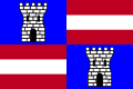 Flag  Coat of arms | |
 Location of Paliseul in Luxembourg province | |
 Interactive map of Paliseul | |
Paliseul Location in Belgium | |
| Coordinates: 49°54′N 05°08′E / 49.900°N 5.133°E / 49.900; 5.133 | |
| Country | Belgium |
| Community | French Community |
| Region | Wallonia |
| Province | Luxembourg |
| Arrondissement | Neufchâteau |
| Government | |
| • Mayor | Philippe Léonard |
| • Governing parties | BOURGMESTRE Action |
| Area | |
• Total | 111.25 km2 (42.95 sq mi) |
| Population (2018-01-01)1 | |
• Total | 5,393 |
| • Density | 48.48/km2 (125.6/sq mi) |
| Postal codes | 6850-6853, 6856 |
| NIS code | 84050 |
| Area codes | 061 |
| Website | (in French) paliseul.be |
Paliseul (French pronunciation: [palizœl]; Walloon: Palijhoû) is a municipality of Wallonia located in the province of Luxembourg, Belgium.
On 1 January 2007 the municipality, which covers 112.96 km2, had 5,055 inhabitants, giving a population density of 44.8 inhabitants per km2.
The municipality consists of the following districts: Carlsbourg, Fays-les-Veneurs, Framont, Maissin, Nollevaux, Offagne, Opont, and Paliseul. Other population centers include: Beth, Bour, Merny, Our, and Plainevaux.
Gallery
-
 Paliseul, church (l'église Saint Eutrope)
 -
 Plainevaux, church (l'église Saint Barbe)
 -
 Nollevaux, church (l'église Saint-Urbain)
References
References
- "Wettelijke Bevolking per gemeente op 1 januari 2018". Statbel. Retrieved 9 March 2019.