| Ormsetvatnet | |
|---|---|
 | |
| Location | Steinkjer Municipality, Trøndelag |
| Coordinates | 63°53′16″N 10°40′22″E / 63.8879°N 10.6729°E / 63.8879; 10.6729 |
| Moldelva river | |
| Basin countries | Norway |
| Max. length | 3.5 kilometres (2.2 mi) |
| Max. width | 3.5 kilometres (2.2 mi) |
Surface area | 4.27 km2 (1.65 sq mi) |
Shore length1 | 14.7 kilometres (9.1 mi) |
Surface elevation | 375 metres (1,230 ft) |
| References | NVE1 |
| Location | |
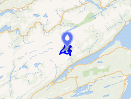 Interactive map of the lake | |
| 1 Shore length is not a well-defined measure. | |
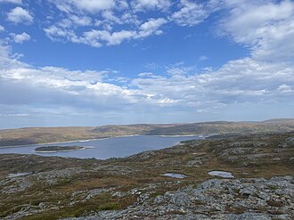
Ormsetvatnet2 is a lake in Steinkjer Municipality in Trøndelag county, Norway. It is located about 10 kilometres (6.2 mi) northeast of the village of Verrabotn. The 4.27-square-kilometre (1.65 sq mi) lake has a dam at the southern end, the water flows out into the short river Moldelva which flows out into an arm of the Trondheimsfjord.3
References
References
- "Innsjødatabase". NVE.no (in Norwegian). Retrieved 2024-11-30.
- "Informasjon om stadnamn". Norgeskart (in Norwegian). Kartverket. Retrieved 2024-11-30.
- "Ormsetvatnet" (in Norwegian). yr.no. Retrieved 2011-07-05.