| Opal Cone | |
|---|---|
 | |
| Highest point | |
| Elevation | 1,736 m (5,696 ft) |
| Prominence | 86 m (282 ft) |
| Coordinates | 49°49′38.0″N 122°58′16.0″W / 49.827222°N 122.971111°W / 49.827222; -122.971111 |
| Geography | |
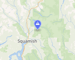
Opal Cone Location in British Columbia | |
 | |
| Interactive map of Opal Cone | |
| Location | Garibaldi Park, British Columbia, Canada |
District | New Westminster Land District |
| Parent range | Garibaldi Ranges |
| Topo map | NTS 92G15 Mamquam Mountain |
| Geology | |
| Rock age | Holocene |
| Cinder cone | |
| Volcanic arc | Canadian Cascade Arc |
| Volcanic belt | Garibaldi Volcanic Belt |
| Last eruption | 9300 BP |
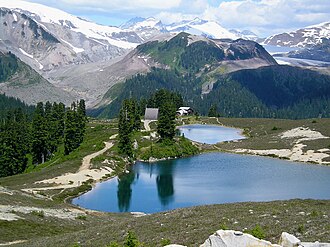
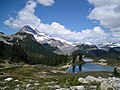
Opal Cone is a cinder cone located on the southeast flank of Mount Garibaldi in the Coast Mountains of British Columbia, Canada. It is the source of a 15 km (9 mi) long broad dacite lava flow with prominent wrinkled ridges. The lava flow is unusually long for a silicic lava flow.
Opal Cone is a member of the Cascade Volcanoes, but it is located in the Garibaldi Ranges in the Coast Mountains and not in the Cascade Range proper.
Gallery
See also
See also
External links
External links
- Opal Cone in the Canadian Mountain Encyclopedia
- Hiking Opal Cone - Online guide for hiking to the summit
References
References
- "Opal Cone". BC Geographical Names. Government of British Columbia – B.C. Geographical Names Office (BCGNO).
- Catalogue of Canadian volcanoes:Opal Cone