Olargues | |
|---|---|
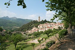 A general view of Olargues | |
 Coat of arms | |
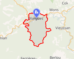 Location of Olargues | |
Olargues Location within France Show map of FranceOlargues Location within Occitanie Show map of Occitanie | |
| Coordinates: 43°33′26″N 2°54′55″E / 43.5572°N 2.9153°E / 43.5572; 2.9153 | |
| Country | France |
| Region | Occitania |
| Department | Hérault |
| Arrondissement | Béziers |
| Canton | Saint-Pons-de-Thomières |
| Government | |
| • Mayor (2020–2026) | Jean Arcas1 |
Area 1 | 18.6 km2 (7.2 sq mi) |
| Population (2023)2 | 488 |
| • Density | 26.2/km2 (68.0/sq mi) |
| Time zone | UTC+01:00 (CET) |
| • Summer (DST) | UTC+02:00 (CEST) |
| INSEE/Postal code | 34187 /34390 |
| Elevation | 148–760 m (486–2,493 ft) (avg. 183 m or 600 ft) |
| 1 French Land Register data, which excludes lakes, ponds, glaciers > 1 km2 (0.386 sq mi or 247 acres) and river estuaries. | |
Olargues (French pronunciation: [ɔlaʁɡ]) is a commune in the Hérault department in the Occitanie region in southern France. It is a member of Les Plus Beaux Villages de France (The Most Beautiful Villages of France) Association.3
Olargues is a good example of a French Medieval town. It was occupied by the Romans, the Vandals and the Visigoths. At the end of the 11th century the Jaur valley came under the authority of the Château of the Viscount of Minerve. The following centuries saw a succession of wars and epidemics, and it was not until the 18th century that Olargues became re-established. This was due to the prosperity of local agriculture and artisanal industry.
Attractions
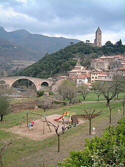
Pont du Diable
The "Devil's Bridge" is said to date back to 1202 and is reputed to be the scene of transactions between the people of Olargues and the "devil". The old village is clustered around the belltower, which was formerly the main tower of the castle (Romanesque construction). The old shops have marble frontages and overhanging upper storeys. A museum of popular traditions and art is to be found in the stairs of the Commanderie.
Population
| Year | Pop. | ±% p.a. |
|---|---|---|
| 1968 | 590 | — |
| 1975 | 518 | −1.84% |
| 1982 | 529 | +0.30% |
| 1990 | 512 | −0.41% |
| 1999 | 571 | +1.22% |
| 2007 | 598 | +0.58% |
| 2012 | 661 | +2.02% |
| 2017 | 679 | +0.54% |
| 2023 | 488 | −5.36% |
| Source: INSEE4 | ||
References
References
- "Répertoire national des élus: les maires". data.gouv.fr, Plateforme ouverte des données publiques françaises (in French). 2 December 2020.
- "Populations de référence 2023" (in French). National Institute of Statistics and Economic Studies. 18 December 2025.
- Les plus beaux villages de France
- Population municipale entre 1968 et 2023, INSEE