| District of Upper Alsace Bezirk Oberelsaß (in German) | |||||||||
|---|---|---|---|---|---|---|---|---|---|
| District of Alsace–Lorraine | |||||||||
| 1871–1918 | |||||||||
 Flag
 Coat of arms
| |||||||||
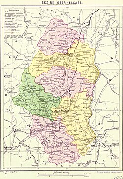 | |||||||||
| Upper Alsace district with its subdistricts in different colours (1890) | |||||||||
| Capital | Kolmar | ||||||||
| Area | |||||||||
• 1885 | 3.508 km2 (1.354 sq mi) | ||||||||
• 1910 | 3.508 km2 (1.354 sq mi) | ||||||||
| Population | |||||||||
• 1885 | 462.549 | ||||||||
• 1910 | 517.865 | ||||||||
| History | |||||||||
| 1870–1871 | |||||||||
• Established | 1871 | ||||||||
• Disestablished | 1918 | ||||||||
| Political subdivisions | 6 rural districts | ||||||||
| |||||||||
| Today part of | France | ||||||||

Upper Alsace (German: Oberelsaß, French: Haute-Alsace) was the southern part of the historical region Alsace. From 1871 to 1918, Bezirk Oberelsaß was a district (Bezirk) in the southern part of the province of Alsace–Lorraine in the German Empire. The district was formed on 30 December 1871 from the former French département of Haut-Rhin, to which it corresponds exactly.12 Its capital was Colmar. It was divided into the districts (Kreise) of:1
- Altkirch within the Sundgau
- Colmar
- Gebweiler (Guebwiller)
- Mülhausen (Mulhouse)
- Rappoltsweiler (Ribeauvillé)
- Thann
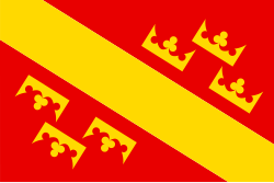
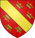
The flag of Oberelsaß is a yellow bar on a red field decorated on each side with three crowns. The combination of this flag with that of Unterelsaß forms the flag of modern Alsace.
References
References
- Jehke, Rolf. "Bezirk Oberelsaß". territorial.de (in German). Retrieved 2 March 2026.
- Silverman, Dan P. (1972). Reluctant Union: Alsace-Lorraine and Imperial Germany, 1871–1918. Pennsylvania State University Press. pp. 30–31. ISBN 0-271-01111-4.