Neidenbach | |
|---|---|
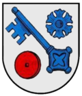 Coat of arms | |
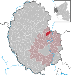
Location of Neidenbach
within Eifelkreis Bitburg-Prüm district
| |
Location of Neidenbach | |
Neidenbach Location within Germany Show map of GermanyNeidenbach Location within Rhineland-Palatinate Show map of Rhineland-Palatinate | |
| Coordinates: 50°05′34″N 6°33′08″E / 50.09278°N 6.55222°E / 50.09278; 6.55222 | |
| Country | Germany |
| State | Rhineland-Palatinate |
| District | Eifelkreis Bitburg-Prüm |
| Municipal assoc. | Bitburger Land |
| Government | |
| • Mayor (2019–24) | Edwin Mattes1 |
| Area | |
• Total | 9.35 km2 (3.61 sq mi) |
| Elevation | 470 m (1,540 ft) |
| Population (2024-12-31)2 | |
• Total | 894 |
| • Density | 95.6/km2 (248/sq mi) |
| Time zone | UTC+01:00 (CET) |
| • Summer (DST) | UTC+02:00 (CEST) |
| Postal codes | 54657 |
| Dialling codes | 06563 |
| Vehicle registration | BIT |
| Website | www.neidenbach.de |
Neidenbach is a municipality in the district of Bitburg-Prüm, in Rhineland-Palatinate, western Germany.
Geography
Neidenbach lies about 45 km north of the city of Trier in the Kyllburger Waldeifel region. Within its municipality are the hamlet of Erntehof 2.5 km northwest of the village and the settlements of Koppenweg, Maierhof, Nickelshof and Am Wasserfall.3
References
References
- Direktwahlen 2019, Eifelkreis Bitburg-Prüm, Landeswahlleiter Rheinland-Pfalz, accessed 6 August 2021.
- "Bevölkerungsstand von Land, Landkreisen, Gemeinden und Verbandsgemeinden 2024 (Einwohnerzahlen auf Grundlage des Zensus 2022)" (in German). Statistisches Landesamt Rheinland-Pfalz.
- Statistisches Landesamt Rheinland-Pfalz – Amtliches Verzeichnis der Gemeinden und Gemeindeteile 2014, page 68 (pdf; 2.4 MB)