Narsawan
Narsāwān | |
|---|---|
Village | |
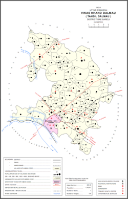 Map showing Narsawan (#947) in Dalmau CD block | |
Narsawan Location in Uttar Pradesh, India | |
| Coordinates: 26°06′56″N 81°04′43″E / 26.115459°N 81.07865°E / 26.115459; 81.078651 | |
| Country India |  India India |
| State | Uttar Pradesh |
| District | Raebareli |
| Area | |
• Total | 3.646 km2 (1.408 sq mi) |
| Population (2011)2 | |
• Total | 3,137 |
| • Density | 860.4/km2 (2,228/sq mi) |
| Languages | |
| • Official | Hindi |
| Time zone | UTC+5:30 (IST) |
| Vehicle registration | UP-35 |
Narsawan is a village in Dalmau block of Rae Bareli district, Uttar Pradesh, India.2 It is located 9 km from Dalmau, the block headquarters.3 As of 2011, it has a population of 3,137 people, in 586 households.2 It has one primary school and no healthcare facilities.2
The 1961 census recorded Narsawan as comprising 7 hamlets, with a total population of 1,383 people (664 male and 719 female), in 289 households and 237 physical houses.4 The area of the village was given as 921 acres.4
The 1981 census recorded Narsawan as having a population of 1,726 people, in 333 households, and having an area of 372.67 hectares.3 The main staple foods were listed as wheat and rice.3
References
References
- "GeoNames Search". geonames.nga.mil. Archived from the original on 12 April 2014.
- "Census of India 2011: Uttar Pradesh District Census Handbook - Rae Bareli, Part A (Village and Town Directory)" (PDF). Census 2011 India. pp. 306–30. Retrieved 18 August 2021.
- Census 1981 Uttar Pradesh: District Census Handbook Part XIII-A: Village & Town Directory, District Rae Bareli (PDF). 1982. pp. 164–5. Retrieved 18 August 2021.
- Census 1961: District Census Handbook, Uttar Pradesh (39 - Raebareli District) (PDF). Lucknow. 1965. pp. lxxviii-lxxix of section "Dalmau Tahsil". Retrieved 18 August 2021.
{{cite book}}: CS1 maint: location missing publisher (link)