| Mount Heber | |
|---|---|
Mount Heber Location on Vancouver Island Show map of Vancouver IslandMount Heber Location in British Columbia Show map of British Columbia | |
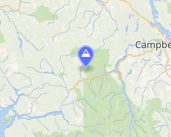 | |
| Interactive map of Mount Heber | |
| Highest point | |
| Elevation | 1,683 m (5,522 ft) |
| Prominence | 533 m (1,749 ft) |
| Coordinates | 49°53′48.8″N 125°55′00.8″W / 49.896889°N 125.916889°W / 49.896889; -125.916889 |
| Geography | |
| Location | Vancouver Island, British Columbia, Canada |
District | Nootka Land District |
| Parent range | Vancouver Island Ranges |
| Topo map | NTS 92F13 Upper Campbell Lake |
Mount Heber is a mountain on Vancouver Island, British Columbia, Canada, located 16 km (10 mi) northeast of Gold River and 8 km (5 mi) west of Big Den Mountain.1
External links
External links
- "Mount Heber". BC Geographical Names. Government of British Columbia – B.C. Geographical Names Office (BCGNO).