| Mount Fable | |
|---|---|
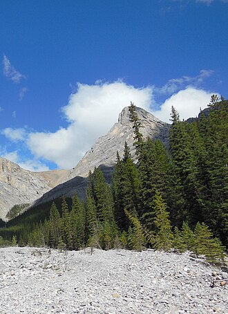 Mount Fable seen from Exshaw Creek approach | |
| Highest point | |
| Elevation | 2,702 m (8,865 ft)1 |
| Prominence | 203 m (666 ft)1 |
| Coordinates | 51°07′6″N 115°13′40″W / 51.11833°N 115.22778°W / 51.11833; -115.22778 |
| Geography | |
Mount Fable Location in Alberta | |
| Location | Alberta |
| Parent range | Fairholme Range |
| Topo map | NTS 82O3 Canmore |
| Climbing | |
| First ascent | 1947 by L. Parker, R.C. Hind and J.F. Tarrant 1 |
| Easiest route | Scramble on the west face |
Mount Fable is located in the Fairholme Range of Alberta. It was first ascended in 1947 by L. Parker, R.C. Hind and J.F. Tarrant.2 It was named Fable by the first ascent party in reference to a story about heavy bush causing a prior attempt to fail, which they considered a fable.1
References
References
- "Mount Fable". Bivouac.com. Retrieved 2019-12-11.
- "Mount Fable". cdnrockiesdatabases.ca. Retrieved 2019-12-11.