| Mount Bago | |
|---|---|
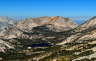 East aspect, with Bullfrog Lake | |
| Highest point | |
| Elevation | 11,870 ft (3,620 m)1 |
| Prominence | 1,142 ft (348 m)1 |
| Parent peak | Peak 125652 |
| Isolation | 2.02 mi (3.25 km)2 |
| Listing | Sierra Peaks Section |
| Coordinates | 36°46′12″N 118°26′17″W / 36.7699936°N 118.4380879°W / 36.7699936; -118.43808793 |
| Naming | |
| Etymology | Unknown4 |
| Geography | |
Mount Bago Location within California Show map of CaliforniaMount Bago Location within the United States Show map of the United States | |
Country | United States |
State | California |
County | Fresno |
Protected area | Kings Canyon National Park |
| Parent range | Sierra Nevada |
| Topo map | USGS Mount Clarence King |
| Geology | |
| Fault block | |
| Rock type | Metamorphic rock |
| Climbing | |
| First ascent | 1896 |
| Easiest route | class 22 East slope |
Mount Bago is an 11,870-foot-elevation (3,620-meter) mountain summit located west of the crest of the Sierra Nevada mountain range, in the southeast corner of Fresno County, in northern California.3 It is situated in Kings Canyon National Park, 14 miles (23 km) west of the community of Independence, 2.3 miles west of the Kearsarge Pinnacles, and 2.4 miles southwest of Mount Rixford. Topographic relief is significant as the south aspect rises 3,675 feet (1,120 meters) above Junction Meadow in one mile. The John Muir Trail passes to the northeast of this remote geographical feature. The first ascent of the summit was made July 11, 1896, by Joseph Nisbet LeConte and Wilson S. Gould.5
Climate
According to the Köppen climate classification system, Mount Bago is located in an alpine climate zone.6 Most weather fronts originate in the Pacific Ocean, and travel east toward the Sierra Nevada mountains. As fronts approach, they are forced upward by the peaks, causing them to drop their moisture in the form of rain or snowfall onto the range (orographic lift). Precipitation runoff from the peak drains into tributaries of Bubbs Creek, which in turn is a tributary of the South Fork Kings River.
Gallery
-
-
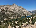 Mt. Bago above Charlotte Lake, from northeast on JMT.
 -
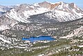 Mount Bago and Bullfrog Lake viewed from Kearsarge Pass
References
References
- "Mount Bago, California". Peakbagger.com. Retrieved May 22, 2021.
- "Bago, Mount - 11,870' CA". ListsOfJohn.com. Retrieved May 22, 2021.
- "Mount Bago". Geographic Names Information System. United States Geological Survey, United States Department of the Interior. Retrieved May 22, 2021.
- Peter Browning, Place Names of the Sierra Nevada, 1986, Wilderness Press, ISBN 9780899970479, page 10.
- R. J. Secor, The High Sierra Peaks, Passes, Trails, 2009, Third Edition, Mountaineers Books, ISBN 9781594857386, page 160.
- Peel, M. C.; Finlayson, B. L.; McMahon, T. A. (2007). "Updated world map of the Köppen-Geiger climate classification" (PDF). Hydrology and Earth System Sciences. 11 (5): 1633–1644. Bibcode:2007HESS...11.1633P. doi:10.5194/hess-11-1633-2007. Archived (PDF) from the original on December 2, 2019. Retrieved November 7, 2025.