| Monte Prado | |
|---|---|
 | |
| Highest point | |
| Elevation | 2,054 m (6,739 ft) |
| Prominence | 288 m (945 ft) |
| Isolation | 3.14 km (1.95 mi) |
| Coordinates | 44°15′00″N 10°24′27″E / 44.25000°N 10.40750°E / 44.25000; 10.40750 |
| Geography | |
Monte Prado | |
| Parent range | Tuscan-Emilian Apennines |
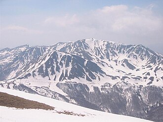
Monte Prado (or Prato) is a mountain in the northern Apennines, located in the trait between the Pradarena and Radici Passes, with an altitude of 2,054 metres (6,739 ft).
Geography
Monte Prado is right on the boundary between the province of Reggio Emilia and that of Lucca.
Environment protection
The mountain is part of the National Park of the Appennino Tosco-Emiliano.1
References
References
- Cime, Ente Parco Nazionale Appennino Tosco-Emiliano web-page on www.parcoappennino.it
See also