Močiar
Kövesmocsár | |
|---|---|
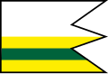 Flag | |
| Coordinates: 48°32′N 18°57′E / 48.54°N 18.95°E / 48.54; 18.95 | |
| Country |  Slovakia Slovakia |
| Region |  Banská Bystrica Region Banská Bystrica Region |
| District | Banská Štiavnica District |
| First mentioned | 1305 |
| Government | |
| • Mayor | Adriana Vančová |
| Area | |
• Total | 20.91 km2 (8.07 sq mi) |
| Elevation | 593 m (1,946 ft) |
| Population | |
• Total | 160 |
| Time zone | UTC+1 (CET) |
| • Summer (DST) | UTC+2 (CEST) |
| Postal code | 969 823 |
| Area code | +421 453 |
| Vehicle registration plate (until 2022) | BS |
| Website | www |
Močiar (Hungarian: Kövesmocsár) is a village and municipality in Banská Štiavnica District, in the Banská Bystrica Region of Slovakia.
Geography
The municipality lies at an altitude of 593 metres (1,946 ft)3 and covers an area of 20.91 km2 (8.07 sq mi) (2025).4
Population
| Year | 1995 | 2005 | 2015 | 2025 |
|---|---|---|---|---|
| Count | 196 | 153 | 165 | 160 |
| Difference | −21.93% | +7.84% | −3.03% |
| Year | 2024 | 2025 |
|---|---|---|
| Count | 165 | 160 |
| Difference | −3.03% |
It has a population of 160 people (31 December 2025).6
Ethnicity
| Ethnicity | Number | Fraction |
|---|---|---|
| Slovak | 160 | 98.15% |
| Not found out | 4 | 2.45% |
| Total | 163 |
In year 2021 was 163 people by ethnicity 160 as Slovak and 4 as Not found out.
Note on population: The difference values of population numbers in the table "Population statistic" and in the sections "Ethnicity" & "Religion" is caused by the use of various statistical methods.
Religion
| Religion | Number | Fraction |
|---|---|---|
| Roman Catholic Church | 135 | 82.82% |
| None | 22 | 13.5% |
| Not found out | 3 | 1.84% |
| Evangelical Church | 3 | 1.84% |
| Total | 163 |
In year 2021 was 163 people by religion 135 from Roman Catholic Church, 22 from None, 3 from Not found out and 3 from Evangelical Church.
References
References
- "Hustota obyvateľstva - obce [om7014rr_obc=AREAS_SK, v_om7014rr_ukaz=Rozloha (Štvorcový meter)]". Statistical Office of the Slovak Republic. 2026-03-31. Retrieved 2026-03-31.
- "Počet obyvateľov podľa pohlavia - obce (ročne) [om7101rr_obce=AREAS_SK]". Statistical Office of the Slovak Republic. 2026-03-31. Retrieved 2026-03-31.
- "Základná charakteristika". www.statistics.sk (in Slovak). Statistical Office of the Slovak Republic. 2015-04-17. Retrieved 2022-03-31.
- "Hustota obyvateľstva - obce [om7014rr_obc=AREAS_SK, v_om7014rr_ukaz=Rozloha (Štvorcový meter)]". Statistical Office of the Slovak Republic. 2026-03-31. Retrieved 2026-03-31.
- "Počet obyvateľov podľa pohlavia - obce (ročne) [om7101rr_obce=AREAS_SK]". Statistical Office of the Slovak Republic. 2026-03-31. Retrieved 2026-03-31.
- "Počet obyvateľov podľa pohlavia - obce (ročne) [om7101rr_obce=AREAS_SK]". Statistical Office of the Slovak Republic. 2026-03-31. Retrieved 2026-03-31.
- "Population - Basic results". www.scitanie.sk. Statistical Office of the Slovak republic. Retrieved 2025-11-03.
- "Population - Basic results". www.scitanie.sk. Statistical Office of the Slovak republic. Retrieved 2025-11-03.
- "Population - Basic results". www.scitanie.sk. Statistical Office of the Slovak republic. Retrieved 2025-11-03.