Mo | |
|---|---|
Village | |
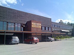 The village school | |
 Interactive map of Mo | |
Mo Mo | |
| Coordinates: 60°25′41″N 11°38′24″E / 60.42796°N 11.64007°E / 60.42796; 11.64007 | |
| Country | Norway |
| Region | Eastern Norway |
| County | Innlandet |
| District | Odalen |
| Municipality | Nord-Odal Municipality |
| Area | |
• Total | 0.58 km2 (0.22 sq mi) |
| Elevation | 141 m (463 ft) |
| Population (2024)1 | |
• Total | 413 |
| • Density | 712/km2 (1,840/sq mi) |
| Time zone | UTC+01:00 (CET) |
| • Summer (DST) | UTC+02:00 (CEST) |
| Post Code | 2133 Gardvik |
Mo3 is a village in Nord-Odal Municipality in Innlandet county, Norway. It is located at the northern end of the lake Storsjøen. The village of Knapper lies about 5 kilometres (3.1 mi) to the north of Mo and the village of Sand lies about 8 kilometres (5.0 mi) to the west of Mo. Mo Church and an elementary school are both located in this village.4
The 0.58-square-kilometre (140-acre) village has a population (2024) of 413 and a population density of 712 inhabitants per square kilometre (1,840/sq mi).1
References
References
- Statistisk sentralbyrå (1 October 2024). "Urban settlements. Population and area, by municipality".
- "Mo, Nord-Odal". yr.no. Retrieved 20 March 2022.
- "Informasjon om stadnamn". Norgeskart (in Norwegian). Kartverket. Retrieved 1 July 2025.
- Thorsnæs, Geir, ed. (26 November 2024). "Mo (tettsted i Nord-Odal)". Store norske leksikon (in Norwegian). Foreningen Store norske leksikon. Retrieved 1 July 2025.