| Mindhola | |
|---|---|
 | |
| Location | |
| Country | India |
| State | Gujarat |
| Physical characteristics | |
| Source | |
| • location | Doswada, Songadh, Gujarat, India |
| Mouth | |
• location | Danti, Arabian Sea, India |
• coordinates | 21°03′45″N 72°43′40″E / 21.06250°N 72.72778°E / 21.06250; 72.72778 |
| Length | 105 km (65 mi) |
| Discharge | |
| • location | Gulf of Cambay, Arabian Sea |
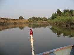
Mindhola River is a river in western India in Gujarat whose origin is near Doswada, Songadh. Its basin has a maximum length of 105 km (65 mi). The total catchment area of the basin is 1,518 km2 (586 sq mi).1
References
References
- "Mindhola River". guj-nwrws.gujarat.gov.in, Government of Gujarat. Retrieved 13 March 2012.