Maizey | |
|---|---|
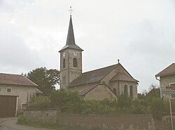 The church in Maizey | |
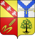 Coat of arms | |
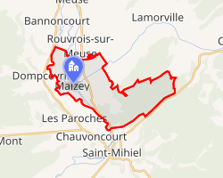 Location of Maizey | |
Maizey Maizey | |
| Coordinates: 48°55′31″N 5°30′45″E / 48.9253°N 5.5125°E / 48.9253; 5.5125 | |
| Country | France |
| Region | Grand Est |
| Department | Meuse |
| Arrondissement | Commercy |
| Canton | Saint-Mihiel |
| Intercommunality | CC Sammiellois |
| Government | |
| • Mayor (2020–2026) | Dominique Didelot1 |
Area 1 | 14.91 km2 (5.76 sq mi) |
| Population (2023)2 | 155 |
| • Density | 10.4/km2 (26.9/sq mi) |
| Time zone | UTC+01:00 (CET) |
| • Summer (DST) | UTC+02:00 (CEST) |
| INSEE/Postal code | 55312 /55300 |
| Elevation | 212–393 m (696–1,289 ft) (avg. 220 m or 720 ft) |
| 1 French Land Register data, which excludes lakes, ponds, glaciers > 1 km2 (0.386 sq mi or 247 acres) and river estuaries. | |
Maizey (French pronunciation: [mɛzɛ]) is a commune in the Meuse department in Grand Est in north-eastern France.
References
References
- "Répertoire national des élus: les maires". data.gouv.fr, Plateforme ouverte des données publiques françaises (in French). 9 August 2021.
- "Populations de référence 2023" (in French). National Institute of Statistics and Economic Studies. 18 December 2025.