Linghem | |
|---|---|
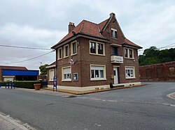 The town hall of Linghem | |
 Coat of arms | |
 Location of Linghem | |
Linghem Linghem | |
| Coordinates: 50°35′41″N 2°22′18″E / 50.5947°N 2.3717°E / 50.5947; 2.3717 | |
| Country | France |
| Region | Hauts-de-France |
| Department | Pas-de-Calais |
| Arrondissement | Béthune |
| Canton | Aire-sur-la-Lys |
| Intercommunality | CA Béthune-Bruay, Artois-Lys Romane |
| Government | |
| • Mayor (2020–2026) | Marcel Blondel1 |
Area 1 | 3.63 km2 (1.40 sq mi) |
| Population (2023)2 | 219 |
| • Density | 60.3/km2 (156/sq mi) |
| Time zone | UTC+01:00 (CET) |
| • Summer (DST) | UTC+02:00 (CEST) |
| INSEE/Postal code | 62517 /62120 |
| Elevation | 36–80 m (118–262 ft) (avg. 48 m or 157 ft) |
| 1 French Land Register data, which excludes lakes, ponds, glaciers > 1 km2 (0.386 sq mi or 247 acres) and river estuaries. | |
Linghem is a commune in the Pas-de-Calais department in the Hauts-de-France region of France3 about 12 miles (19 km) northwest of Béthune and 34 miles (55 km) west of Lille.
Population
| Year | Pop. | ±% p.a. |
|---|---|---|
| 1968 | 263 | — |
| 1975 | 257 | −0.33% |
| 1982 | 224 | −1.94% |
| 1990 | 229 | +0.28% |
| 1999 | 230 | +0.05% |
| 2007 | 214 | −0.90% |
| 2012 | 214 | +0.00% |
| 2017 | 205 | −0.86% |
| 2023 | 219 | +1.11% |
| Source: INSEE4 | ||
References
References
- "Répertoire national des élus: les maires". data.gouv.fr, Plateforme ouverte des données publiques françaises (in French). 9 August 2021.
- "Populations de référence 2023" (in French). National Institute of Statistics and Economic Studies. 18 December 2025.
- INSEE commune file
- Population municipale entre 1968 et 2023, INSEE