Lescheroux | |
|---|---|
Commune | |
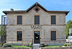 Town hall | |
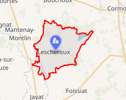 Location of Lescheroux | |
Lescheroux Lescheroux | |
| Coordinates: 46°24′27″N 5°08′50″E / 46.4075°N 5.1472°E / 46.4075; 5.1472 | |
| Country | France |
| Region | Auvergne-Rhône-Alpes |
| Department | Ain |
| Arrondissement | Bourg-en-Bresse |
| Canton | Replonges |
| Intercommunality | CA Bassin de Bourg-en-Bresse |
| Government | |
| • Mayor (2020–2026) | Aimé Nicolier1 |
Area 1 | 20.05 km2 (7.74 sq mi) |
| Population (2023)2 | 726 |
| • Density | 36.2/km2 (93.8/sq mi) |
| Time zone | UTC+01:00 (CET) |
| • Summer (DST) | UTC+02:00 (CEST) |
| INSEE/Postal code | 01212 /01560 |
| Elevation | 182–223 m (597–732 ft) (avg. 210 m or 690 ft) |
| 1 French Land Register data, which excludes lakes, ponds, glaciers > 1 km2 (0.386 sq mi or 247 acres) and river estuaries. | |
Lescheroux is a commune in the Ain department in eastern France.
Geography
The Sâne Vive has its source in the commune; it crosses the village and forms part of the commune's northern border.
The Sâne Morte forms part of the commune's northeastern border.
The Reyssouze flows northwest through the southwestern part of the commune.
Population
| Year | Pop. | ±% p.a. |
|---|---|---|
| 1968 | 593 | — |
| 1975 | 526 | −1.70% |
| 1982 | 504 | −0.61% |
| 1990 | 527 | +0.56% |
| 1999 | 597 | +1.40% |
| 2007 | 691 | +1.84% |
| 2012 | 688 | −0.09% |
| 2017 | 735 | +1.33% |
| 2023 | 726 | −0.21% |
| Source: INSEE3 | ||
References
References
- "Répertoire national des élus: les maires" (in French). data.gouv.fr, Plateforme ouverte des données publiques françaises. 13 September 2022. Archived from the original on 28 June 2020. Retrieved 6 May 2024.
- "Populations de référence 2023" (in French). National Institute of Statistics and Economic Studies. 18 December 2025.
- Population municipale entre 1968 et 2023, INSEE