Leirbotn | |
|---|---|
Village | |
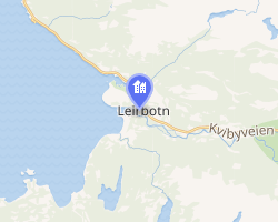 Interactive map of Leirbotn | |
Leirbotn Leirbotn | |
| Coordinates: 70°07′08″N 23°23′28″E / 70.11889°N 23.39111°E / 70.11889; 23.39111 | |
| Country | Norway |
| Region | Northern Norway |
| County | Finnmark |
| District | Vest-Finnmark |
| Municipality | Alta Municipality |
| Elevation | 6 m (20 ft) |
| Time zone | UTC+01:00 (CET) |
| • Summer (DST) | UTC+02:00 (CEST) |
| Post Code | 9519 Kviby |
Leirbotn is a village in Alta Municipality in Finnmark county, Norway. The village is located along the Altafjorden, about 6 kilometres (3.7 mi) west of the European route E06 highway in the northeastern part of Alta Municipality. The village, together with Kviby and Krokelv, form a little urban area about 30 kilometres (19 mi) north of the town of Alta. Leirbotn Church is located in this village.2
References
References
- "Leirbotn" (in Norwegian). yr.no. Retrieved 21 January 2013.
- Store norske leksikon. "Leirbotn" (in Norwegian). Retrieved 21 January 2013.