| Lava Fork | |
|---|---|
 | |
| Location | |
| Country | Canada, United States |
| Province/State | British Columbia, Alaska |
| Physical characteristics | |
| Mouth | Blue River (Alaska) |
• location | Ketchikan Gateway Borough, Alaska |
• coordinates | 56°18′48″N 130°51′55″W / 56.31333°N 130.86528°W / 56.31333; -130.86528 |
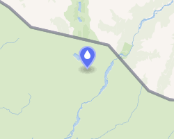
Lava Fork is a creek in northwestern British Columbia, Canada and the Alaska Panhandle, United States. It lies west of the Unuk River and northwest of Stewart. It flows south from the Lava Lakes across the British Columbia-Alaska border into the Blue River12 in the extreme northern part of Misty Fjords National Monument.
The Volcano, a cinder cone about 5 km (3.1 mi) north of the British Columbia-Alaska border in northwestern British Columbia, is the source for lava flows that overwhelm the Canadian and American sides of the creek, hence the creek's name.
See also
See also
References
References
- "Lava Fork". BC Geographical Names. Government of British Columbia – B.C. Geographical Names Office (BCGNO).
- "Lava Fork". Geographic Names Information System. United States Geological Survey, United States Department of the Interior.