Lasseter Highway | |
|---|---|
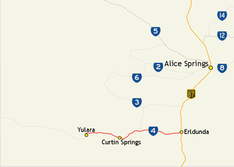 | |
Map of central Australia with Lasseter Highway highlighted in red | |
| General information | |
| Type | Highway |
| Length | 244 km (152 mi) |
| Route number(s) | |
| Major junctions | |
| West end | |
| |
| East end | |
| Location(s) | |
| Major settlements | Yulara, Curtin Springs, Mount Ebenezer |
| Highway system | |
Lasseter Highway is a fully sealed 244 km (152 mi) highway in the Northern Territory of Australia.1 It connects Yulara, Kata Tjuta and Uluru east to the Stuart Highway at Erldunda.2 The highway is named after Lewis Hubert (Harold Bell) Lasseter, who claimed to have discovered a fabulously rich gold reef (Lasseter's Reef) west of Kata Tjuta.3
Junctions
| Location | km4 | mi | Destinations | Notes | |
|---|---|---|---|---|---|
| Yulara | 0 | 0.0 | Route 4 continues to Kata Tjuta then to the Western Australian border becoming the Great Central Road | ||
| Yulara Drive | |||||
| 1.5 | 0.93 | Giles Street | |||
| Petermann | 95 | 59 | Mulga Park Road | ||
| 180 | 110 | ||||
| Ghan | 288 | 179 | |||
| 1.000 mi = 1.609 km; 1.000 km = 0.621 mi | |||||
-
 Looking east along the Lasseter Highway toward Erldunda
 -
 Lasseter Highway at Mount Conner Lookout near Lake Amadeus, March 2010
 -
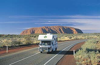 Driving on the Lasseter Highway near the Uluru-Kata Tjuta National Park in the Northern Territory.
See also
See also
References
References
- Hema, Maps (2007). Australia Road and 4WD Atlas (Map). Eight Mile Plains Queensland: Hema Maps. pp. 100–101. ISBN 978-1-86500-456-3.
- Department of Transport (April 1998). "Map of all NT Roads" (PDF). Northern Territory Government. Archived from the original (PDF) on 5 May 2013. Retrieved 13 January 2014.
- Brooks, Sally (2 September 2011). "Photo essay" (PDF). Centralian Advocate. p. 7. Archived (PDF) from the original on 3 June 2014. Retrieved 3 June 2014.
- "Lasseter Highway" (Map). Google Maps. Retrieved 18 January 2017.