| Larstinden | |
|---|---|
| Store Larstind (historic) | |
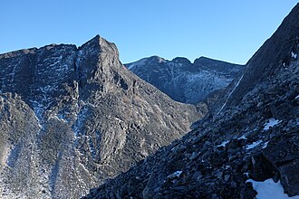 View of Larstinden seen from Store Langvasstinden | |
| Highest point | |
| Elevation | 2,108 m (6,916 ft)1 |
| Prominence | 266 m (873 ft)1 |
| Parent peak | Snøhetta1 |
| Isolation | 1.1 km (0.68 mi)1 |
| Coordinates | 62°19′13″N 9°13′19″E / 62.3204°N 9.22182°E / 62.3204; 9.221822 |
| Geography | |
| Interactive map of the mountain | |
| Location | Innlandet, Norway |
| Parent range | Dovrefjell |
Larstinden3 is a mountain in Lesja Municipality in Innlandet county, Norway. The 2,108-metre (6,916 ft) tall mountain lies within Dovrefjell-Sunndalsfjella National Park, about 30 kilometres (19 mi) north of the village of Dombås. The mountain is surrounded by several other mountains including Drugshøi which is about 3 kilometres (1.9 mi) to the northwest, Store Langvasstinden which is about 1.1 kilometres (0.68 mi) to the west, Nordre Svånåtinden which is about 2 kilometres (1.2 mi) to the southwest, Storstyggesvånåtinden which is 3.5 kilometres (2.2 mi) to the south, and Snøhetta which is about 3 kilometres (1.9 mi) to the east.
References
References
- "Larstinden". PeakVisor.com. Retrieved 10 April 2022.
- "Larstinden, Lesja" (in Norwegian). yr.no. Retrieved 10 April 2022.
- "Informasjon om stadnamn". Norgeskart (in Norwegian). Kartverket. Retrieved 17 August 2025.