| Lackavrea | |
|---|---|
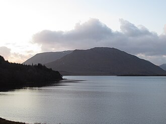 Lackavrea from the east with Corcogemore, and the full Maumturks range behind it. | |
| Highest point | |
| Elevation | 396 m (1,299 ft)1 |
| Prominence | 301 m (988 ft)1 |
| Listing | Marilyn |
| Coordinates | 53°29′10″N 9°31′55″W / 53.486062°N 9.531986°W / 53.486062; -9.5319861 |
| Naming | |
| Native name | Leic Aimhréidh (Irish) |
English translation | rugged rock-slab |
| Geography | |
Lackavrea Location in Ireland | |
| Location | County Galway, Ireland |
| Parent range | Maumturks |
| OSI/OSNI grid | L983495 |
| Topo map | OSi Discovery 451 |
| Geology | |
| Pale quartzites, grits, graphitic top1 | |
Lackavrea (Irish: Leic Aimhréidh; rugged rock-slab)23 is a 396-metre (1,299 ft) isolated mountain in County Galway, Ireland. It is located to the east of the larger Maumturks range, which lies within the Connemara region.1
See also
See also
References
References
- "Lackavrea". MountainViews. Retrieved 2 June 2019.
- Placenames Database of Ireland
- Paul Tempan (February 2012). "Irish Hill and Mountain Names" (PDF). MountainViews.ie.