Kyvalley | |
|---|---|
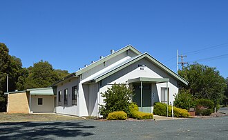 Kyvalley Hall, 2017 | |
Kyvalley | |
| Coordinates: 36°17′2″S 145°0′21″E / 36.28389°S 145.00583°E / -36.28389; 145.00583 | |
| Country | Australia |
| State | Victoria |
| LGA | |
| Location |
|
| Government | |
| • State electorate | |
| • Federal division | |
| Population | |
| • Total | 328 (2011 census)2 |
| Postcode | 3621 |
Kyvalley is a locality in the Goulburn Valley region of Victoria, Australia. The locality is in the Shire of Campaspe, 218 kilometres (135 mi) north of the state capital, Melbourne.
At the 2011 census, Kyvalley and the surrounding area had a population of 328.2
References
References
- Australian Bureau of Statistics (28 June 2022). "Kyvalley (suburb and locality)". Australian Census 2021 QuickStats. Retrieved 28 June 2022.
- Australian Bureau of Statistics (31 October 2012). "Kyvalley (State Suburb)". 2011 Census QuickStats. Retrieved 4 February 2017.