Königerode | |
|---|---|
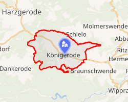 Location of Königerode | |
Königerode Königerode | |
| Coordinates: 51°36′6″N 11°12′14″E / 51.60167°N 11.20389°E / 51.60167; 11.20389 | |
| Country | Germany |
| State | Saxony-Anhalt |
| District | Harz |
| Town | Harzgerode |
| Area | |
• Total | 14.64 km2 (5.65 sq mi) |
| Elevation | 370 m (1,210 ft) |
| Population (2019-12-31)1 | |
• Total | 729 |
| • Density | 49.8/km2 (129/sq mi) |
| Time zone | UTC+01:00 (CET) |
| • Summer (DST) | UTC+02:00 (CEST) |
| Postal codes | 06493 |
| Dialling codes | 039484 |
| Vehicle registration | HZ |
Königerode is a village and a former municipality in the district of Harz, Saxony-Anhalt, Germany. Since 1 August 2009, it is part of the town Harzgerode.
References
References
- "Entwicklung von Harzgerode: Mehr Zuzüge, aber sinkende Einwohnerzahl". Mitteldeutsche Zeitung. 15 January 2020. Retrieved 27 September 2021.