Jhangar
Jhanger | |
|---|---|
Village | |
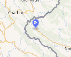 Interactive map of Jhangar | |
Jhangar Location in Jammu and Kashmir, India Show map of Jammu and KashmirJhangar Jhangar (India) Show map of India | |
| Coordinates: 33°14′18″N 74°03′12″E / 33.238446°N 74.053341°E / 33.238446; 74.053341 | |
| Country |  India India |
| Union territory | Jammu and Kashmir |
| District | Rajouri |
| Time zone | UTC+5:30 (IST) |
Jhangar or Jhanger is a village in the Rajouri district of Indian-administered Jammu and Kashmir, close to the Line of Control that divides the Indian and Pakistan-administered portions of Kashmir.
History
Prior to 1947, Jhangar was the base of the Mirpur–Poonch Brigade of the State Forces of the princely state of Jammu and Kashmir.1 It was at a strategic location that was roughly equidistant from the towns of Bhimber, Mirpur, Kotli and Rajouri.2 It was fiercely contested between the Indian and Pakistani forces during the Indo-Pakistani War of 1947–1948, eventually coming under Indian control.3 The village faces frequent shelling from Pakistan.4
References
References
- Brahma Singh, History of Jammu and Kashmir Rifles (2010), pp. 9, 207.
- Brahma Singh, History of Jammu and Kashmir Rifles (2010), pp. 9, 246: "Jhangar is situated on the junction of Mirpur-Jammu and Kotli-Jammu roads and its occupation by own troops was of vital importance for the survival of both the Mirpur and Kotli garrisons."
- Brahma Singh, History of Jammu and Kashmir Rifles (2010), p. 26.
- Jhangar lives in constant fear of death, United News of India, 1 May 2019.
Bibliography
Bibliography
- Dasgupta, C. (2014) [first published 2002], War and Diplomacy in Kashmir, 1947-48, SAGE Publications, ISBN 978-81-321-1795-7
- Singh, K. Brahma (1990), History of Jammu and Kashmir Rifles, 1820-1956: The State Force Background, Lancer International, ISBN 978-81-7062-091-4
- Singh, K. Brahma (2010) [first published Lancer International 1990], History of Jammu and Kashmir Rifles, 1820-1956: The State Force Background (PDF), brahmasingh.co.nf, ISBN 978-81-7062-091-4, archived from the original (PDF) on 6 March 2016
- Palit, D. K. (1972), Jammu and Kashmir Arms: History of the J & K Rifles, Palit & Dutt
- Raghavan, Srinath (2010), War and Peace in Modern India, Palgrave Macmillan, ISBN 978-1-137-00737-7