Irrel | |
|---|---|
 Coat of arms | |
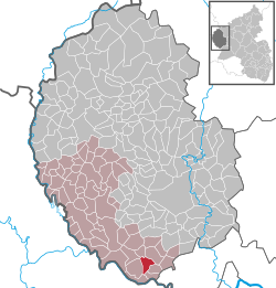
Location of Irrel
within Eifelkreis Bitburg-Prüm district
| |
 Location of Irrel | |
Irrel Irrel | |
| Coordinates: 49°50′50″N 06°27′22″E / 49.84722°N 6.45611°E / 49.84722; 6.45611 | |
| Country | Germany |
| State | Rhineland-Palatinate |
| District | Eifelkreis Bitburg-Prüm |
| Municipal assoc. | Südeifel |
| Government | |
| • Mayor (2019–24) | Herbert Theis1 |
| Area | |
• Total | 7.05 km2 (2.72 sq mi) |
| Elevation | 170 m (560 ft) |
| Population (2024-12-31)2 | |
• Total | 1,737 |
| • Density | 246/km2 (638/sq mi) |
| Time zone | UTC+01:00 (CET) |
| • Summer (DST) | UTC+02:00 (CEST) |
| Postal codes | 54666 |
| Dialling codes | 06525 |
| Vehicle registration | BIT |
| Website | Irrel at site www.suedeifelinfo.de |
Irrel is a municipality in the district Bitburg-Prüm, in Rhineland-Palatinate, Germany. It is situated in the Eifel, near the border with Luxembourg, at the confluence of the rivers Prüm and Nims. It is located approximately 15 km south-west of Bitburg and 5 km north-east of Echternach.
Irrel was the seat of the former Verbandsgemeinde ("collective municipality") Irrel. Since 1 July 2014 it is part of the Verbandsgemeinde Südeifel.3
Sights
References
References
- Direktwahlen 2019, Eifelkreis Bitburg-Prüm, Landeswahlleiter Rheinland-Pfalz, accessed 6 August 2021.
- "Bevölkerungsstand von Land, Landkreisen, Gemeinden und Verbandsgemeinden 2024 (Einwohnerzahlen auf Grundlage des Zensus 2022)" (in German). Statistisches Landesamt Rheinland-Pfalz.
- "Die Verbandsgemeinde Südeifel" (in German). Verbandsgemeinde Südeifel. July 2014. Retrieved 5 May 2015.