| Mount Iremel | |
|---|---|
 | |
| Highest point | |
| Elevation | 1,589 m (5,213 ft) |
| Coordinates | 54°30′54″N 58°50′24″E / 54.51500°N 58.84000°E / 54.51500; 58.84000 |
| Geography | |
Mount Iremel Mount Iremel (European Russia) Show map of European Russia | |
| Parent range | Ural Mountains |
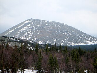
Iremel (Bashkir: Ирәмәл, Russian: Иремель) is a compact mountain ridge in the Southern Ural Mountains in the republic of Bashkortostan, Russian Federation (bordering with Chelyabinsk Oblast to the north-west). The highest peak, Bolshoy Iremel (Big Iremel), or simply Iremel, stands at 1,589 metres (5200 ft) high. Maly Iremel (Small Iremel), 6 kilometers north-east, stands at 1,449 meters. It is the source of the 1,430 kilometres long River Belaya.12
The highest peak of the South Urals, Mount Yamantaw (1,638 meters) is located 53 kilometers south-west from Bolshoy Iremel.
Gallery

References
References
- "Иремель" (in Russian). Большая российская энциклопедия. Archived from the original on 2020-02-05. Retrieved 2019-05-23.
- "Иремель" (in Russian). Большая Советская Энциклопедия. Retrieved 2019-05-23.