


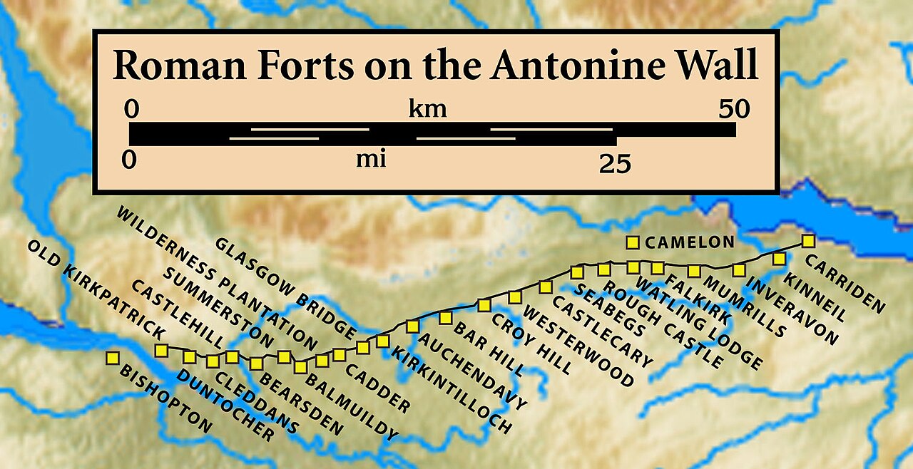
Inveravon is sited on the east side of the River Avon in Scotland. It was long considered to be the likely site for a Roman Fort on the Antonine Wall in Scotland. The fort is one of the most dubious1 on the wall although some excavation and geophysics has been done.2 Near Inveravon Tower, the bare traces of a fort were found but there is nothing that an unskilled visitor could identify.3 Several excavations have unearthed the site's foundations as well as a section of the Military Way. Cobbled surfaces and some stone walls were found.4 Also ‘expansions’ were discovered, perhaps used as signal or beacon towers.5
Two temporary marching camps have been found.6 In the 1950s aerial photography brought these to light. News about them was circulated in the Journal of Roman Studies by J.K. St. Joseph. The sites are south of the Wall and south-east of Inveravon.7 In 1960, aerial photography revealed a 3rd camp. It was also south of the Wall. Additional camps at Mumrills and on either side of Grangemouth Golf Course have been identified.89
Many Roman forts along the wall held garrisons of around 500 men.10 Larger forts like Castlecary and Birrens had a nominal cohort of 1000 men11 but probably sheltered women and children12 as well although the troops were not allowed to marry.13 There is likely too to have been large communities of civilians around the site.14
References
References
- Rohl, Darrell, Jesse. "More than a Roman Monument: A Place-centred Approach to the Long-term History and Archaeology of the Antonine Wall" (PDF). Durham Theses. Durham University. Available at Durham E-Theses Online ref: 9458. Retrieved 14 October 2017.
{{cite web}}: CS1 maint: multiple names: authors list (link) - "Inveravon, Antonine Wall". CANMORE. Royal Commission on the Ancient and Historical Monuments of Scotland. Retrieved 18 November 2017.
- "Inveravon". Frontiers of the Roman Empire (site by site). Retrieved 18 November 2017.
- Robertson, Anne S. (September 2010). "RECENT WORK ON THE ANTONINE WALL". Glasgow Archaeological Journal. 1 (1): 37–42. Retrieved 2 June 2018.
- "INVERAVON: FORT AND TEMPORARY CAMPS" (PDF). Frontiers of the Roman Empire. Retrieved 18 November 2017.
- "Inveravon Camps Temporary Marching Camps". Roman Britain. Retrieved 18 November 2017.
- "OS 25 inch map 1892-1949, with Bing opacity slider". National Library of Scotland. Ordnance Survey. Retrieved 12 October 2017.
- "Inveravon". OpenStreetMap. Retrieved 18 November 2017.
- "Polmonthill". Frontiers of the Roman Empire (site by site). Retrieved 18 November 2017.
- "Soldier". Frontiers of the Roman Empire. Archived from the original on 2 August 2020. Retrieved 21 October 2017.
- Miller, S. N. (1952). The Roman Occupation Of South Western Scotland Being Reports Of Excavations And Surveys Carried Out Under The Auspices Of The Glasgow Archaeological Society By John Clarke, J. M. Davidson, Anne S. Robertson, J. K. St. Joseph, Edited For The Society With An Historical Survey By S. N. Miller. Glasgow: Robert Maclehose & Company Limited. Retrieved 11 October 2017.
- "Children". Frontiers of the Roman Empire. Archived from the original on 2 August 2020. Retrieved 21 October 2017.
- "Roman child's leather shoe". A History of the World. BBC. Retrieved 17 October 2017.
- Rohl, Darrell, Jesse. "More than a Roman Monument: A Place-centred Approach to the Long-term History and Archaeology of the Antonine Wall" (PDF). Durham Theses. Durham University. Available at Durham E-Theses Online ref: 9458. Retrieved 14 October 2017.
{{cite web}}: CS1 maint: multiple names: authors list (link)
56°00′05″N 3°40′33″W / 56.0013°N 3.6758°W / 56.0013; -3.6758