Injapur | |
|---|---|
Town | |
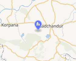 Interactive map of Injapur | |
| Country |  India India |
| State | Telangana |
| Languages | |
| • Official | Telugu |
| Time zone | UTC+5:30 (IST) |
| Telephone code | 040 |
| Vehicle registration | TS-08 X XXXX |
Injapur is an urban village in Rangareddy district in Telangana, India. It falls under Abdullapurmet mandal and administration under Turkayamjal Municipality.1 It is 9 km within the Outer Ring Road, Hyderabad.It is located just adjuscent to LB Nagar constituency.Located centre connecting in between Sagar Highway, Vijayawada high way @Hayathnagar. Injapur village surrounded its south with vast greenary forest and Masabh Cheruvu. Govt of Telangana finalised to merge this village into GHMC Hyderabad.
References
References
- "Tragic end to pleasure trip". The Hindu. 16 August 2006. Retrieved 17 September 2018.
19°43′N 79°07′E / 19.717°N 79.117°E / 19.717; 79.117