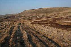
Howden Edge (grid reference SK187943) is a hill in the north-east of the Upper Derwent Valley area of the Peak District National Park in England.The highest point on Howden Edge, marked only on 1:25,000 scale maps and larger, is High Stones at 548 m (1,798 ft), the highest point within the boundaries of both the City of Sheffield and South Yorkshire, England.1
Howden Edge is north-east of Howden Reservoir and north of Abbey Brook.
References
References
- Bathurst, David (2012). Walking the county high points of England. Chichester: Summersdale. pp. 192–201. ISBN 978-1-84-953239-6.
53°26′43″N 1°43′12″W / 53.44514°N 1.71993°W / 53.44514; -1.71993