Hottó | |
|---|---|
Village | |
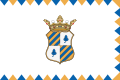 Flag  Coat of arms | |
Hottó Location of Hottó | |
| Coordinates: 46°50′48″N 16°45′11″E / 46.84675°N 16.75297°E / 46.84675; 16.75297 | |
| Country | Hungary |
| Region | Western Transdanubia |
| County | Zala |
| District | Zalaegerszeg |
| Area | |
• Total | 6.7 km2 (2.6 sq mi) |
| Population (1 January 2025)1 | |
• Total | 332 |
| • Density | 50/km2 (130/sq mi) |
| Time zone | UTC+1 (CET) |
| • Summer (DST) | UTC+2 (CEST) |
| Postal code | 8991 |
| Area code | (+36) 92 |
Hottó is a village in Zala County, Hungary.2
References
References
- Detailed Gazetteer of Hungary. 30 September 2025 https://www.ksh.hu/apps/hntr.telepules?p_lang=EN&p_id=28325. Retrieved 1 October 2025.
{{cite web}}: Missing or empty|title=(help) - Hungarian Central Statistical Office