Hohenhameln | |
|---|---|
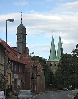 Village center | |
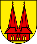 Coat of arms | |
Location of Hohenhameln
within Peine district | |
 Location of Hohenhameln | |
Hohenhameln Hohenhameln | |
| Coordinates: 52°15′36″N 10°03′59″E / 52.26000°N 10.06639°E / 52.26000; 10.06639 | |
| Country | Germany |
| State | Lower Saxony |
| District | Peine |
| Government | |
| • Mayor (2021–26) | Uwe Semper1 (SPD) |
| Area | |
• Total | 69.59 km2 (26.87 sq mi) |
| Elevation | 101 m (331 ft) |
| Population (2024-12-31)2 | |
• Total | 9,396 |
| • Density | 135.0/km2 (349.7/sq mi) |
| Time zone | UTC+01:00 (CET) |
| • Summer (DST) | UTC+02:00 (CEST) |
| Postal codes | 31249 |
| Dialling codes | 05128 |
| Vehicle registration | PE |
| Website | www.hohenhameln.de |
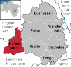
Hohenhameln (German pronunciation: [ˌhoːənˈhaːml̩n]) is a municipality in the district of Peine, in Lower Saxony, Germany. It is situated approximately 15 km southwest of Peine, 15 km northeast of Hildesheim and 25 km southeast of Hanover.
Places that belong to the Hohenhameln community

Hohenhameln, Soßmar, Clauen, Bierbergen, Bründeln, Equord, Harber, Mehrum, Ohlum, Rötzum, Stedum
Twinnings
 Hankasalmi, Finland3
References
References
- "Stichwahlen zu Direktwahlen in Niedersachsen vom 26. September 2021" (PDF). Landesamt für Statistik Niedersachsen. 13 October 2021.
- "Tabelle EVAS 12411, Fortschreibung des Bevölkerungsstandes auf Basis des Zensus 2022, Stand 31. Dezember 2024" (in German). Landesamt für Statistik Niedersachsen.
- "Deutsche Botschaft Helsinki" (in Finnish). Embassy of Germany in Finland. Archived from the original on 7 July 2007. Retrieved 7 May 2012.