| Hochstollen | |
|---|---|
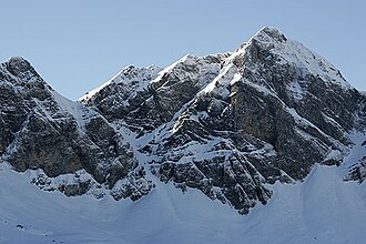 The east face | |
| Highest point | |
| Elevation | 2,481 m (8,140 ft) |
| Prominence | 160 m (520 ft)1 |
| Parent peak | Glogghüs |
| Coordinates | 46°46′25″N 8°14′16″E / 46.77361°N 8.23778°E / 46.77361; 8.23778 |
| Geography | |
Hochstollen Location in Switzerland | |
| Location | Obwalden, Switzerland |
| Parent range | Urner Alps |
The Hochstollen is a mountain of the Urner Alps, located between the Klein Melchtal and the Melchtal in the canton of Obwalden. The border with the canton of Bern runs south of the summit.
The closest locality is Melchsee-Frutt on its east side.
References
References
- Retrieved from the Swisstopo topographic maps. The key col is the Wit Ris (2,321 m).