| Hida River | |
|---|---|
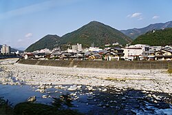 The Hida River flowing through Gero | |
  | |
| Native name | 飛騨川 (Japanese) |
| Location | |
| Country | Japan |
| Physical characteristics | |
| Source | |
| • location | Mount Norikura |
| • elevation | 3,026 m (9,928 ft) |
| Mouth | |
• location | Kiso River |
| Length | 148 km (92 mi) |
Basin size | 2,170 km2 (840 sq mi) |
| Basin features | |
| River system | Kiso River |
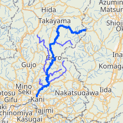
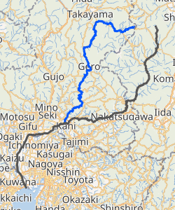
The Hida River (飛騨川, Hida-gawa) has its source in Mount Norikura (乗鞍岳 Norikura-ga-take) in Takayama, Gifu Prefecture, Japan. It flows from the northern to the southern section of the prefecture before emptying into the Kiso River in Minokamo.12
River communities
The river passes through or forms the boundary of the communities listed below.
References
References
- "一級河川木曽川水系 飛騨川圏域河川整備計画" (PDF). www.pref.gifu.lg.jp. Archived (PDF) from the original on 2023-02-10. Retrieved 2023-02-10.
- "飛騨川". kotobank.jp. Archived from the original on 2023-02-10. Retrieved 2023-02-10.
External links
External links
35°26′46″N 137°03′09″E / 35.446241°N 137.052444°E / 35.446241; 137.052444 (mouth)