Heukewalde | |
|---|---|
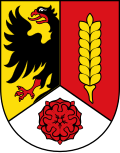 Coat of arms | |
Location of Heukewalde
within Altenburger Land district | |
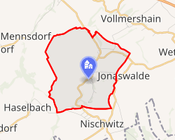 Location of Heukewalde | |
Heukewalde Heukewalde | |
| Coordinates: 50°50′10″N 12°16′3″E / 50.83611°N 12.26750°E / 50.83611; 12.26750 | |
| Country | Germany |
| State | Thuringia |
| District | Altenburger Land |
| Municipal assoc. | Oberes Sprottental |
| Government | |
| • Mayor (2022–28) | Maik Piewak1 |
| Area | |
• Total | 5.89 km2 (2.27 sq mi) |
| Elevation | 275 m (902 ft) |
| Population (2024-12-31)2 | |
• Total | 188 |
| • Density | 31.9/km2 (82.7/sq mi) |
| Time zone | UTC+01:00 (CET) |
| • Summer (DST) | UTC+02:00 (CEST) |
| Postal codes | 04626 |
| Dialling codes | 034496 |
| Vehicle registration | ABG |
| Website | www.heukewalde.de |
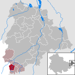
Heukewalde is a German municipality in the Thuringian Landkreis of Altenburger Land. It belongs to the Verwaltungsgemeinschaft of Oberes Sprottental.
Geography
Neighboring Municipalities
Communities near Heukewalde include: Jonaswalde, Posterstein, and Vollmershain in the Landkreis of Altenburger Land; as well as Rückersdorf und Paitzdorf in the Landkreis of Greiz.
History
Heukewalde was first mentioned in writing on December 9, 1152. From 1826 to 1920, it belonged to Saxe-Altenburg.
Mayors
Bernhard Göpel, mayor from 1892 to 1917.
References
References
- Gewählte Bürgermeister - aktuelle Landesübersicht, Freistaat Thüringen, accessed 10 November 2022.
- "Bevölkerung der Gemeinden vom Thüringer Landesamt für Statistik" (in German). Thüringer Landesamt für Statistik.