Harbarnsen | |
|---|---|
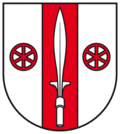 Coat of arms | |
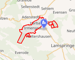 Location of Harbarnsen | |
Harbarnsen Harbarnsen | |
| Coordinates: 51°59′N 09°58′E / 51.983°N 9.967°E / 51.983; 9.967 | |
| Country | Germany |
| State | Lower Saxony |
| District | Hildesheim |
| Municipality | Lamspringe |
| Area | |
• Total | 15.03 km2 (5.80 sq mi) |
| Elevation | 189 m (620 ft) |
| Population (2015-12-31) | |
• Total | 555 |
| • Density | 36.9/km2 (95.6/sq mi) |
| Time zone | UTC+01:00 (CET) |
| • Summer (DST) | UTC+02:00 (CEST) |
| Postal codes | 31097 |
| Dialling codes | 05060 |
| Vehicle registration | HI |
Harbarnsen is a village and a former municipality in the district of Hildesheim in Lower Saxony, Germany. Since 1 November 2016, it is part of the municipality Lamspringe.
Geography
Harbarnsen is situated in an agricultural region between the Weserbergland Schaumburg-Hameln Nature Park and the Harz, roughly 9 km southwest of Bad Salzdetfurth. Surrounding hill ranges, namely Sackwald, Harplage and Heber, are parts of the Lower Saxon Hills.
Division of the municipality
The municipality of Harbarnsen consisted of two districts, Harbarnsen and Irmenseul.
-
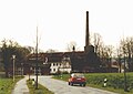 Old distillery in Harbarnsen, 1991
 -
 Irminsul reproduction in Irmenseul