Halumsa
Persian: هلومسر | |
|---|---|
Village | |
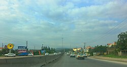 Haraz Road in Halumsar | |
Halumsa | |
| Coordinates: 36°24′27″N 52°20′43″E / 36.40750°N 52.34528°E / 36.40750; 52.345281 | |
| Country | Iran |
| Province | Mazandaran |
| County | Amol |
| District | Emamzadeh Abdollah |
| Rural District | Bala Khiyaban-e Litkuh |
| Population (2016)2 | |
• Total | 956 |
| Time zone | UTC+3:30 (IRST) |
Halumsar (Persian: هلومسر)a is a village in Bala Khiyaban-e Litkuh Rural District4 of Emamzadeh Abdollah District in Amol County, Mazandaran province, Iran.
Demographics
The village's people speak Mazandarani and Persian and are Shia Muslim.5
Villagers have been active in cultivating rice, wheat, barley and walnut. Coal preparation and scarf weaving have also been common among villagers. Before tap water access, the main source of water was Haraz River.
Population
| Year | Pop. | ±% |
|---|---|---|
| 1950 | 1705 | — |
| 1956 | 2546 | +49.4% |
| 1966 | 3897 | +53.1% |
| 1976 | 4608 | +18.3% |
| 1986 | 6309 | +37.0% |
| 2006 | 778 | +23.5% |
| 2011 | 922 | +18.5% |
| 2016 | 956 | +3.7% |
Halumsar at the time of the 1966 census had a population of 389 people in 66 households. It has had elementary school, mosque, radio connection and village council.7 The 1976 census measured a population of 460 in 83 households.8 In 1986, its population reached 630 in 111 households, and the village gained electricity by that time.9
At the time of the 2006 National Census, the village's population was 778 in 188 households, when it was in the Central District.10 The following census in 2011 counted 922 people in 296 households,11 by which time the rural district had been separated from the district in the formation of Emamzadeh Abdollah District.12 The 2016 census measured the population of the village as 956 people in 314 households.2
References
References
- OpenStreetMap contributors (26 December 2025). "هلومسر, دهستان بالاخیابان لیتکوه, بخش امامزاده عبدالله [Halumsar, Bala Khiyaban-e Litkuh Rural District, Emamzadeh Abdollah District], Amol County, Mazandaran Province, Iran" (Map). OpenStreetMap (in Persian). Retrieved 26 December 2025.
- سرشماري عمومي نفوس و مسكن 1395 : استان مازندران [General Population and Housing Census 2016: Mazandaran Province]. مرکز آمار ایران [Statistical Centre of Iran] (in Persian). Archived from the original (Excel) on 7 October 2021. Retrieved 19 December 2022.
- Halumsar at GEOnet Names Server
- Mousavi, Mir-Hossein (9 August 1987) [تاریخ تصویب (Approval date) 1366/05/18 (Iranian Jalali calendar)]. ایجاد و تشکیل تعداد 4 دهستان شامل روستاها، مزارع و مکانها در شهرستان تنکابن تابع استان مازندران [Creation and formation of 11 rural districts including villages, farms, places in Amol County under Mazandaran province]. مرکز پژوهشهای مجلس شورای اسلامی ایران [Research Center of the Islamic Consultative Assembly of Iran] (in Persian). وزارت کشور [Ministry of the Interior]. مجلس شورای اسلامی [Islamic Consultative Assembly]. پیشنهاد شماره [Proposal No.] 11698.1.5.53. Archived from the original on 26 September 2017. Retrieved 23 December 2025.
- "Halum Sar, Amol - Province No.2" (PDF) (in Persian). Retrieved 19 October 2025., from the Geographical Culture of Iran, Vol 3 - Province No.2, page 328, Geographical bureau of Army Headquarters, published September 1950, Author: Hosseyn Ali Razmara
- "Detailed Report of Amol Census area" (PDF) (in Persian). Statistical Center of Iran. July 1959 [Data gathered on November 1956]. p. 21. Retrieved 1 October 2025.
- "1966 Census Results: Mazandaran" (PDF) (in Persian). Statistical Center of Iran. September 1969 [Data gathered on November 1966]. p. 16. Retrieved 19 October 2025.
- "1976 Census Results: Mazandaran" (PDF) (in Persian). Statistical Center of Iran. September 1982 [Data gathered on November 1976]. p. 23. Retrieved 19 October 2025.
- "1986 census results: Amol, Mazandaran" (PDF) (in Persian). Statistical Center of Iran. pp. 28, 29. Retrieved 26 September 2025.
- سرشماري عمومي نفوس و مسكن 1385 : استان مازندران [General Population and Housing Census 2006: Mazandaran Province]. مرکز آمار ایران [Statistical Centre of Iran] (in Persian). Archived from the original (Excel) on 20 September 2011. Retrieved 25 September 2022.
- سرشماري عمومي نفوس و مسكن 1390 : استان مازندران [General Population and Housing Census 2011: Mazandaran Province]. Iran Data Portal—Syracuse University (in Persian). مرکز آمار ایران [Statistical Centre of Iran]. Archived from the original (Excel) on 19 January 2023. Retrieved 19 December 2022.
- Rahimi, Mohammad Reza (11 August 2010) [مصوب (Approved on) 1389/05/20 (Iranian Jalali calendar)]. اصلاحات و تغييرات تقسيماتي در شهرستان هاي ساري و آمل [Reforms and changes in divisions in Sari and Amol Counties]. سامانه ملی قوانین و مقررات [National System of Laws and Regulations] (in Persian). وزارت کشور [Ministry of the Interior]. کمیسیون سیاسی دفاعی هیأت دولت [Political Defense Commission of the Government Board]. پيشنهاد شماره [Proposal number] 1/4/42/126400. Archived from the original on 21 May 2023. Retrieved 23 December 2025.