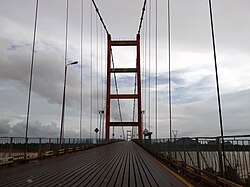
Gyaing River1 (Burmese: ဂျိုင်းမြစ်) is a river of Kayin State and Mon State, in southeastern Burma (Myanmar). Its two major tributaries, the Hlaingbwe River and the Haungtharaw River, flow together to form the Gyaing2 at 16°36′12″N 98°00′25″E / 16.60333°N 98.00694°E / 16.60333; 98.00694.3 It is about 45 miles (72 km) long2 and flows into the Salween River immediately above Moulmein, at 16°30′55″N 97°37′36″E / 16.51528°N 97.62667°E / 16.51528; 97.62667 (its mouth).3
The Gyaing is a wide river, but quite shallow with numerous sandbars.2 It is navigable by smaller boats all year long.2 Important towns and villages along its banks include Gadoe (Kado), Zathabyin (Zathabyeng),4 Kalagong, Kawbein, Peinnegon,5 Tarana6 and Damathat (Dhammatha). The up-stream Gyaing forms part of the border between Hpa-an District and Kawkareik District of Kayin State, and downstream is the border between Kayin State and Mon State.1
Notes
Notes
- "Map of Kayin State" Archived 2011-06-15 at the Wayback Machine Myanmar's net
- Hunter, William Wilson (1881) The Imperial Gazetteer of India page 497, OCLC 278111153
- "Burma 1:250,000 topographic map, Series U542, Moulmein, NE 47-14" U.S. Army Map Service, December 1959
- "Zathabyin Map — Satellite Images of Zathabyin" Maplandia World Gazetteer
- "Peinnegon Map — Satellite Images of Peinnegon" Maplandia World Gazetteer
- "Tarana Map — Satellite Images of Tarana" Maplandia World Gazetteer
Further reading
Further reading
- Finch, Roger (2006) "Journey up the Gyaing" Stations of the Sun Somerset Hall Press, Boston, Massachusetts, page 91, ISBN 0-9774610-3-3; poem