Gurdari | |
|---|---|
Village | |
Gurdari Location in Jharkhand, India Show map of JharkhandGurdari Gurdari (India) Show map of India | |
| Coordinates: 23°20′03″N 84°15′09″E / 23.334048°N 84.252568°E / 23.334048; 84.252568 | |
| Country |  India India |
| State | Jharkhand |
| District | Gumla |
| Government | |
| • Type | Federal democracy |
| Population (2011) | |
• Total | 3,432 |
| Languages * | |
| • Official | Hindi, Urdu |
| Time zone | UTC+5:30 (IST) |
| PIN | 835220 |
| Telephone/ STD code | 06524 |
| Vehicle registration | JH 07 |
| Literacy | 70.14% |
| Lok Sabha constituency | Lohardaga |
| Vidhan Sabha constituency | Bishunpur |
| Website | gumla |
Gurdari is a village/ Bauxite mining centre in the Bishunpur CD block in the Gumla subdivision of the Gumla district in the Indian state of Jharkhand.
Geography

10.6miles
River
River
Wildlife
Sanctuary

Falls
M: municipality, CT: census town, R: rural/ urban centre, H: historical/ religious centre, T: tourist centre, B: Bauxite mining centre
Owing to space constraints in the small map, the actual locations in a larger map may vary slightly
Location
Gurdari is located at 23°20′03″N 84°15′09″E / 23.334048°N 84.252568°E / 23.334048; 84.252568
Area overview
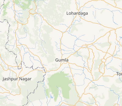
The map alongside presents a rugged area, consisting partly of flat-topped hills called pat and partly of an undulating plateau, in the south-western portion of Chota Nagpur Plateau. Three major rivers – the Sankh, South Koel and North Karo - along with their numerous tributaries, drain the area. The hilly area has large deposits of Bauxite. 93.7% of the population lives in rural areas.12
Note: The map alongside presents some of the notable locations in the district. All places marked in the map are linked in the larger full screen map.
Civic administration
There is a police station at Gurdari.3
Demographics
According to the 2011 Census of India, Gurdari had a total population of 3,432, of which 1,864 (54%) were males and 1,568 (46%) were females. Population in the age range 0–6 years was 622. The total number of literate persons in Gurdari was 1,971 (70.14% of the population over 6 years).4
(*For language details see Bishunpur block#Language and religion)
Bauxite mining
Bauxite and laterite (aluminium ore) is found in "villages of Amtipani, Langdatanr, Chirodih, Jalim, Narma, Bahagara and Gurdari of Bishunpur block, Langatanr, Lupungpat and Chota-agiatu in Chainpur block and Hanrup, Serengdag and Jalim in Ghaghra block. The total number of bauxite mines is twenty one".5
In Gumla district the mines are operated manually/ semi-mechanised methods. After blasting, manual sorting and sizing of bauxite from the run of mine ore is practiced in the mine.67
Gurdari Bauxite Mining Project, covering 584.19 ha, is operated by Hindalco Industries.8
References
References
- "District Census Handbook, Gumla, Series 21, Part XII A" (PDF). page 7: Natural Divisions, Page 38: 2011 Census Findings–Population and its Distribution. Directorate of Census Operations Jharkhand. Retrieved 29 October 2021.
- "Chota Nagpur plateau". Britannica. Retrieved 29 October 2021.
- "District Police Profile - Gumla". Jharkhand Police. Archived from the original on 5 October 2021. Retrieved 25 October 2021.
- "District Census Handbook, Gumla, Series 21, Part XII B" (PDF). Rural PCA-C.D. blocks wise Village Primary Census Abstract, location no. 375487, pages 54-55. Directorate of Census Operations Jharkhand. Retrieved 25 October 2021.
- "District Gumla:Backward Region Grant Fund, Annual Action Plan, 2011-2012" (PDF). Page 6: Natural Resources / Minerals. District Administration, Gumla. Retrieved 25 October 2021.
- "Mining and Production of Bauxite in India" (PDF). Bauxite Monograph. Retrieved 25 October 2021.
- "MCDR Inspection Report" (PDF). Page 6: Exploitation. Indian Bureau of Mines – Minerals Development and Regulation Department. Retrieved 25 October 2021.
- "Environment Clearance for Gurdari Bauxite Mining Project" (PDF). Page 6. Hindalco – Aditya Birla Group. Retrieved 25 October 2021.