| Guil | |
|---|---|
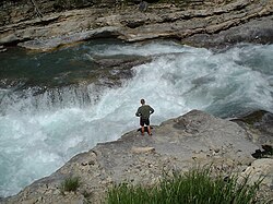 The Guil. | |
 | |
| Location | |
| Country | France |
| Physical characteristics | |
| Source | |
| • location | Ristolas |
| • coordinates | 44°41′14″N 07°03′56″E / 44.68722°N 7.06556°E / 44.68722; 7.06556 |
| • elevation | 2,510 m (8,230 ft) |
| Mouth | |
• location | Durance |
• coordinates | 44°40′01″N 06°36′05″E / 44.66694°N 6.60139°E / 44.66694; 6.60139 |
• elevation | 875 m (2,871 ft) |
| Length | 51.6 km (32.1 mi) |
Basin size | 727 km2 (281 sq mi) |
| Discharge | |
| • average | 17 m3/s (600 cu ft/s) |
| Basin features | |
| Progression | Rhône→ Mediterranean Sea |
The Guil (French: le Guil) is a 51.6-kilometre (32.1 mi) long river in the Hautes-Alpes département, southeastern France.1 Its drainage basin is 727 km2 (281 sq mi).2 Its source is several small streams which converge into the lake Lestio, at Ristolas. It flows generally west, through the Queyras. It is a left tributary of the Durance into which it flows at Guillestre.
Communes along its course
This list is ordered from source to mouth: Ristolas, Abriès, Aiguilles, Château-Ville-Vieille, Arvieux, Eygliers, Guillestre
References
References
- Sandre. "Fiche cours d'eau - Le Guil (X02-0400)".
- Bassin versant : Guil (Le), Observatoire Régional Eau et Milieux Aquatiques en PACA