Grosbliederstroff | |
|---|---|
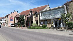 City hall and post office | |
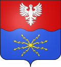 Coat of arms | |
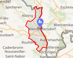 Location of Grosbliederstroff | |
Grosbliederstroff Grosbliederstroff | |
| Coordinates: 49°10′N 7°02′E / 49.16°N 7.03°E / 49.16; 7.03 | |
| Country | France |
| Region | Grand Est |
| Department | Moselle |
| Arrondissement | Sarreguemines |
| Canton | Sarreguemines |
| Intercommunality | CA Sarreguemines Confluences |
| Government | |
| • Mayor (2020–2026) | Pascal Weisslinger1 |
Area 1 | 13.07 km2 (5.05 sq mi) |
| Population (2023)2 | 3,346 |
| • Density | 256.0/km2 (663.1/sq mi) |
| Time zone | UTC+01:00 (CET) |
| • Summer (DST) | UTC+02:00 (CEST) |
| INSEE/Postal code | 57260 /57520 |
| Elevation | 105–357 m (344–1,171 ft) (avg. 189 m or 620 ft) |
| 1 French Land Register data, which excludes lakes, ponds, glaciers > 1 km2 (0.386 sq mi or 247 acres) and river estuaries. | |
Grosbliederstroff (French pronunciation: [ɡʁosblidɛʁstʁɔf]; German: Großblittersdorf, lit. 'Big Blittersdorf', in contrast to "Little Blittersdorf") is a commune in the Moselle department in Grand Est in north-eastern France.
It borders the German towns of Saarbrücken (180,000 inhabitants) and Kleinblittersdorf.
Grosbliederstroff is connected to Kleinblittersdorf by a bridge and from there to Saarbrücken by tramway, and to French highways A320 and A4.
Geography
Grosbliederstroff is situated on the left bank of the river Saar (Sarre), opposite the German village Kleinblittersdorf, and about midway between Saarbrücken and Sarreguemines.
Climate
| Climate data for Grosbliederstroff | |||||||||||||
|---|---|---|---|---|---|---|---|---|---|---|---|---|---|
| Month | Jan | Feb | Mar | Apr | May | Jun | Jul | Aug | Sep | Oct | Nov | Dec | Year |
| Mean daily maximum °C (°F) | 3 (37) |
4 (39) |
9 (48) |
13 (55) |
18 (64) |
21 (70) |
23 (73) |
23 (73) |
19 (66) |
14 (57) |
7 (45) |
4 (39) |
13 (56) |
| Mean daily minimum °C (°F) | −1 (30) |
−1 (30) |
−2 (28) |
4 (39) |
8 (46) |
11 (52) |
13 (55) |
13 (55) |
10 (50) |
7 (45) |
2 (36) |
0 (32) |
5 (42) |
| Average precipitation mm (inches) | 54 (2.1) |
42 (1.7) |
38 (1.5) |
38 (1.5) |
46 (1.8) |
49 (1.9) |
50 (2.0) |
40 (1.6) |
39 (1.5) |
52 (2.0) |
59 (2.3) |
61 (2.4) |
568 (22.3) |
| Source: worldweather.org | |||||||||||||
Population
| Year | Pop. | ±% p.a. |
|---|---|---|
| 1968 | 3,218 | — |
| 1975 | 3,279 | +0.27% |
| 1982 | 3,163 | −0.51% |
| 1990 | 3,092 | −0.28% |
| 1999 | 3,334 | +0.84% |
| 2007 | 3,305 | −0.11% |
| 2012 | 3,321 | +0.10% |
| 2017 | 3,303 | −0.11% |
| 2023 | 3,346 | +0.22% |
| Source: INSEE3 | ||
History
777: Foundation
Former names:
- 777 : Blithario Villa
- 1220 : Bliederstroff
- 1223 : Bliderstorff
- 1594 : Grossblietersdorff
- 1756 : Blidertorf-le-Grand
- 1779 : Blidestroff-le-Gros
Sister cities
 Kleinblittersdorf (Germany)
References
References
- "Répertoire national des élus: les maires". data.gouv.fr, Plateforme ouverte des données publiques françaises (in French). 9 August 2021.
- "Populations de référence 2023" (in French). National Institute of Statistics and Economic Studies. 18 December 2025.
- Population municipale entre 1968 et 2023, INSEE