| Gratlspitze | |
|---|---|
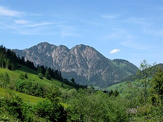 The Gratlspitz from the Alpbach (southern) side | |
| Highest point | |
| Elevation | 1,899 m (AA) (6,230 ft) |
| Coordinates | 47°24′54″N 11°56′52″E / 47.4149389°N 11.9476611°E / 47.4149389; 11.9476611 |
| Geography | |
| Parent range | Kitzbühel Alps |
The Gratlspitze12 or Gratlspitz, is a mountain in the Austrian state of Tyrol in the Kitzbühel Alps. It is linked to the Schatzberg to the north.
In addition to its 1,899 m (AA) high main summit it has two subpeaks, that give it a striking appearance. The mountain lies between the Alpine valleys of Wildschönau and the Alpbach.
There are long views from the summit as a result of its exposed situation as a relatively isolated mountain.
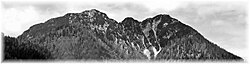
Silver mining was carried out on the mountain for many years. Several gallery entrances and heaps of waste rock are very still visible today (see photo below of the Wildschönauer side).
References
References
- Bundesamt für Eich- und Vermessungswesen: Austrian map series 1:50.000, AMAP Online Archived 2022-09-01 at the Wayback Machine, accessed on 18 January 2011
- Alpenvereinskarte 34/1 Kitzbüheler Alpen, West, 2003.