Garies | |
|---|---|
 Garies | |
Garies Garies Garies | |
| Coordinates: 30°33′28″S 17°59′22″E / 30.55778°S 17.98944°E / -30.55778; 17.98944 | |
| Country | South Africa |
| Province | Northern Cape |
| District | Namakwa |
| Municipality | Kamiesberg |
| Area | |
• Total | 69.44 km2 (26.81 sq mi) |
| Population (2011)1 | |
• Total | 2,105 |
| • Density | 30.31/km2 (78.51/sq mi) |
| Racial makeup (2011) | |
| • Black African | 9.0% |
| • Coloured | 79.1% |
| • Indian/Asian | 0.5% |
| • White | 10.1% |
| • Other | 1.2% |
| First languages (2011) | |
| • Afrikaans | 96.0% |
| • Other | 4.0% |
| Time zone | UTC+2 (SAST) |
| Postal code (street) | 8220 |
| PO box | 8220 |
| Area code | 027 |
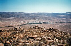
Garies is a small agricultural centre situated in South Africa's Northern Cape province about 110 km south of Springbok, the chief town of the Namaqualand district. Current population approximately 1500.
The Letterklip provincial heritage site is situated just west of town.
The town is in the Namaqualand district, at the foot of the Kamiesberg, 46 km south of Kamieskroon and 146 km northwest of Vanrhynsdorp. The name is Khoekhoen and means ‘couchgrass’, Afrikaans ‘kweek’.2
References
References
- "Main Place Garies". Census 2011.
- "Dictionary of Southern African Place Names (Public Domain)". Human Science Research Council. p. 173.