| Galdeberget | |
|---|---|
 | |
| Interactive map of the mountain | |
| Highest point | |
| Elevation | 2,075 m (6,808 ft)2 |
| Prominence | 415 m (1,362 ft)2 |
| Parent peak | Mesmogtinden |
| Isolation | 2 km (1.2 mi) to Slettmarkpiggen2 |
| Coordinates | 61°22′39″N 8°25′38″E / 61.37749°N 8.42721°E / 61.37749; 8.427211 |
| Geography | |
| Location | Innlandet, Norway |
| Parent range | Jotunheimen |
| Topo map | 1517 I Tyin |
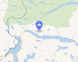
Galdeberget3 is a mountain in Vang Municipality in Innlandet county, Norway. The 2,075-metre (6,808 ft) tall mountain is located in the Jotunheimen mountains on the north shore of the lake Bygdin, about 30 kilometres (19 mi) northwest of the village of Vang i Valdres. The mountain is surrounded by several other notable mountains including Uksedalshøe to the southwest, Snøholstinden and Høgbrøthøgde to the northwest, Slettmarkkampen and Slettmarkpiggen to the north, Langedalstinden to the northeast, and Torfinnstindane and Nørdre Kalvehølotinden to the east.2
References
References
- "Galdeberget, Vang" (in Norwegian). yr.no. Retrieved 21 August 2022.
- "Galdebergtind". PeakVisor.com. Retrieved 21 August 2022.
- "Informasjon om stadnamn". Norgeskart (in Norwegian). Kartverket. Retrieved 27 August 2025.