Friesack | |
|---|---|
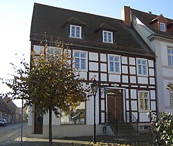 Museum and library | |
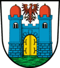 Coat of arms | |
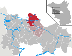
Location of Friesack
within Havelland district | |
 Location of Friesack | |
Friesack Friesack | |
| Coordinates: 52°44′N 12°35′E / 52.733°N 12.583°E / 52.733; 12.583 | |
| Country | Germany |
| State | Brandenburg |
| District | Havelland |
| Municipal assoc. | Friesack |
| Subdivisions | 2 Ortsteile |
| Government | |
| • Mayor (2024–29) | Lothar Schneider1 (SPD) |
| Area | |
• Total | 84.01 km2 (32.44 sq mi) |
| Elevation | 35 m (115 ft) |
| Population (2024-12-31)2 | |
• Total | 2,545 |
| • Density | 30.29/km2 (78.46/sq mi) |
| Time zone | UTC+01:00 (CET) |
| • Summer (DST) | UTC+02:00 (CEST) |
| Postal codes | 14662 |
| Dialling codes | 033235 |
| Vehicle registration | HVL |
| Website | www.amt-friesack.de |
Friesack (German pronunciation: [ˈfʁiːzak] ⓘ; also Friesack/Mark) is a town in the Havelland district, in Brandenburg, in north-eastern Germany. It is situated 22 km (14 mi) northeast of Rathenow, and 25 km (16 mi) southwest of Neuruppin. It is known for its Mesolithic archaeological site.

History
During World War II, in September 1943, the Oflag 8 prisoner-of-war camp was relocated from Frauenberg to Wutzetz, present-day district of Friesack.3 Polish, Greek, Bulgarian and Romanian officers were held in the camp before its dissolution in April 1945.3
Film shot in Friesack
- 1923 : Die Schlucht des Todes (The Ravine of Death) directed by Luciano Albertini and Albert-Francis Bertoni
Demography

Friesack: Population development within the current boundaries (2017)4 | ||||||||||||||||||||||||||||||||||||||||||||||||||||||||||||||||||||||||||||||||||||||||||||||||||||||||||||||||||||||||||||||||||||||
|
|
| ||||||||||||||||||||||||||||||||||||||||||||||||||||||||||||||||||||||||||||||||||||||||||||||||||||||||||||||||||||||||||||||||||||
Sons and daughters of the town

- Emil Schallopp (1843-1919), chess master and writer
- Karsten Wettberg (born 1941), football coach
- Adalbert von Bredow (1814-1890), Prussian general
References
References
- Landkreis Havelland Wahl der Bürgermeisterin / des Bürgermeisters. Retrieved 10 July 2024.
- "Bevölkerungsstand im Land Brandenburg Dezember 2024 (Fortgeschriebene amtliche Einwohnerzahlen, basierend auf dem Zensus 2023)" (XLS). Amt für Statistik Berlin-Brandenburg (in German).
- Megargee, Geoffrey P.; Overmans, Rüdiger; Vogt, Wolfgang (2022). The United States Holocaust Memorial Museum Encyclopedia of Camps and Ghettos 1933–1945. Volume IV. Indiana University Press, United States Holocaust Memorial Museum. pp. 211–212. ISBN 978-0-253-06089-1.
- Detailed data sources are to be found in the Wikimedia Commons.Population Projection Brandenburg at Wikimedia Commons