Fridolfing | |
|---|---|
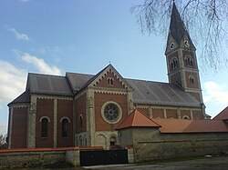 Assumption of the Virgin Mary Church | |
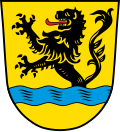 Coat of arms | |
Location of Fridolfing
within Traunstein district | |
 Location of Fridolfing | |
Fridolfing Fridolfing | |
| Coordinates: 48°0′N 12°49′E / 48.000°N 12.817°E / 48.000; 12.817 | |
| Country | Germany |
| State | Bavaria |
| Admin. region | Oberbayern |
| District | Traunstein |
| Government | |
| • Mayor (2020–26) | Johann Schild1 (SPD) |
| Area | |
• Total | 44.22 km2 (17.07 sq mi) |
| Elevation | 388 m (1,273 ft) |
| Population (2024-12-31)2 | |
• Total | 4,337 |
| • Density | 98.08/km2 (254.0/sq mi) |
| Time zone | UTC+01:00 (CET) |
| • Summer (DST) | UTC+02:00 (CEST) |
| Postal codes | 83413 |
| Dialling codes | 08684 |
| Vehicle registration | TS |
| Website | www.fridolfing.de |
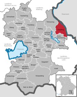
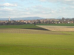
Fridolfing (German pronunciation: [ˈfʁiːdɔlfɪŋ]) is a municipality in the district of Traunstein in Bavaria, Germany.
References
References
- Liste der ersten Bürgermeister/Oberbürgermeister in kreisangehörigen Gemeinden, Bayerisches Landesamt für Statistik, 15 July 2021.
- "Gemeinden, Kreise und Regierungsbezirke in Bayern, Einwohnerzahlen am 31. Dezember 2024; Basis Zensus 2022" [Municipalities, counties, and administrative districts in Bavaria; Based on the 2022 Census] (CSV) (in German). Bayerisches Landesamt für Statistik.