Freihung | |
|---|---|
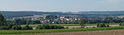 Freihung | |
 Flag  Coat of arms | |
Location of Freihung
within Amberg-Sulzbach district | |
 Location of Freihung | |
Freihung Freihung | |
| Coordinates: 49°37′N 11°55′E / 49.617°N 11.917°E / 49.617; 11.917 | |
| Country | Germany |
| State | Bavaria |
| Admin. region | Oberpfalz |
| District | Amberg-Sulzbach |
| Government | |
| • Mayor (2020–26) | Uwe König1 (FW) |
| Area | |
• Total | 46.35 km2 (17.90 sq mi) |
| Highest elevation | 438 m (1,437 ft) |
| Lowest elevation | 418 m (1,371 ft) |
| Population (2024-12-31)2 | |
• Total | 2,545 |
| • Density | 54.91/km2 (142.2/sq mi) |
| Time zone | UTC+01:00 (CET) |
| • Summer (DST) | UTC+02:00 (CEST) |
| Postal codes | 92271 |
| Dialling codes | 09646, 09622 (Groß-/Kleinschönbrunn) |
| Vehicle registration | AS |
| Website | www |

Freihung (German pronunciation: [ˈfʁaɪʊŋ]) is a municipality in the district of Amberg-Sulzbach in Bavaria in Germany.
Geography
Apart from Freihung the municipality consists of the following villages:3
- Blauenneuschacht
- Böcklmühle
- Elbart
- Freihungsand
- Großschönbrunn
- Hämmerleinshof
- Hämmerleinsmühle
- Kleinschönbrunn
- Konradinsgrund
- Mauerhof
- Riedhof
- Rothaar
- Rumpelmühle
- Schallermühle
- Schickenhof
- Schmelzmühle
- Schwadermühle
- Seugast
- Tanzfleck
- Thansüß
- Weickenricht
Notable people
- Johannes Stark (born 15 April 1874 in Schickenhof – 21 June 1957), physicist and winner of the Nobel Prize in Physics in 1919
References
References
- Liste der ersten Bürgermeister/Oberbürgermeister in kreisangehörigen Gemeinden, Bayerisches Landesamt für Statistik, 15 July 2021.
- "Gemeinden, Kreise und Regierungsbezirke in Bayern, Einwohnerzahlen am 31. Dezember 2024; Basis Zensus 2022" [Municipalities, counties, and administrative districts in Bavaria; Based on the 2022 Census] (CSV) (in German). Bayerisches Landesamt für Statistik.
- "Ortsteile mit Postleitzahl". Retrieved 2024-02-15.