| Femunden | |
|---|---|
 | |
| Location | Innlandet and Trøndelag |
| Coordinates | 62°12′N 11°52′E / 62.200°N 11.867°E / 62.200; 11.867 |
| Type | glacier mountain lake |
| Gløta | |
| 1,793.94 km2 (692.64 sq mi) | |
| Basin countries | Norway |
| Max. length | 60 km (37 mi) |
| Max. width | 9 km (5.6 mi) |
Surface area | 203.4 km2 (78.5 sq mi) |
Average depth | 29.5 m (97 ft) |
| Max. depth | 150 m (490 ft) |
Water volume | 6.04 km3 (1.45 cu mi) |
Shore length1 | 234.92 km (145.97 mi) |
Surface elevation | 662 m (2,172 ft) |
| Islands | Store Sollerøya |
| References | NVE1 |
| Location | |
 Interactive map of the lake | |
| 1 Shore length is not a well-defined measure. | |
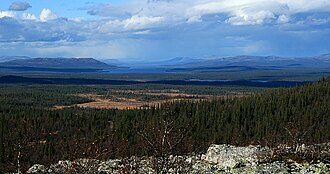
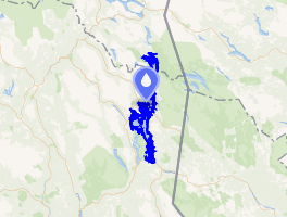
Femunden2 is Norway's third largest lake and the second largest natural lake in Norway. It is located in Innlandet and Trøndelag counties in Norway, just 13 km (8.1 mi) west of the border with Sweden. The lake lies primarily in Engerdal Municipality (in Innlandet) and also smaller parts are located in Os Municipality (Innlandet) and Røros Municipality (Trøndelag). Femundsmarka National Park borders the northeastern part of the lake.3
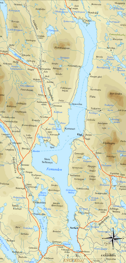
The 203.4-square-kilometre (78.5 sq mi) lake holds about 6 km3 (1.4 cu mi) of water and reaches a maximum depth of 150 m (490 ft). The surface of the lake sits about 662 m (2,172 ft) above sea level.
Name
The first element (Fe- or Fem-) has no known meaning, and the last element is the suffix -mund or -und (both are common in Norwegian place names). The final part -en is the definite article in the Norwegian language.3
History
After Sweden had conquered the parishes of Idre and Särna in 1644, the lake Femunden was considered to be part of the border between Norway and Sweden. But this was never officially recognised by the Dano-Norwegian government (since Norway was ruled from Copenhagen in the early modern age), and during border adjustments in 1751 the Femundsmarka area east of the lake was granted to Norway from Sweden.
The new (and current) border from 1751 is quite special: For a length of 61 kilometres (38 mi), it makes a completely straight line between the summits of the 1,002-metre (3,287 ft) tall mountain Våndsjögusten and the 1,185-metre (3,888 ft) tall mountain Østerhogna. Straight-line national borders are very unusual in Scandinavia, except in the very northernmost parts.
References
References
- "Innsjødatabase". NVE.no (in Norwegian). Retrieved 2024-12-30.
- "Informasjon om stadnamn". Norgeskart (in Norwegian). Kartverket. Retrieved 2024-12-30.
- Store norske leksikon. "Femunden" (in Norwegian). Retrieved 2011-02-25.
External links
External links
- National Park Brochure from 2011 (in English)
- Map of Femund and the adjacent Femundsmarka National Park Archived 2012-03-29 at the Wayback Machine (in Norwegian)
- Stereoscopic 3Dpicture and field recording of the Femundsmarka National Park