Etzgen | |
|---|---|
 Flag  Coat of arms | |
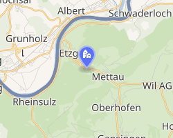 Location of Etzgen | |
Etzgen Etzgen | |
| Coordinates: 47°34′N 8°7′E / 47.567°N 8.117°E / 47.567; 8.117 | |
| Country | Switzerland |
| Canton | Aargau |
| District | Laufenburg |
| Area | |
• Total | 3.28 km2 (1.27 sq mi) |
| Elevation | 336 m (1,102 ft) |
| Population (December 2006) | |
• Total | 438 |
| • Density | 134/km2 (346/sq mi) |
| Time zone | UTC+01:00 (CET) |
| • Summer (DST) | UTC+02:00 (CEST) |
| Postal code | 5275 |
| SFOS number | 4162 |
| ISO 3166 code | CH-AG |
| Surrounded by | Albbruck (DE-BW), Laufenburg (DE-BW), Mettau, Oberhofen, Schwaderloch, Sulz |
| Website | www.etzgen.ch |
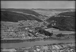
Etzgen was a municipality in the district of Laufenburg in the canton of Aargau in Switzerland. On 1 January 2010, the municipalities of Hottwil, Etzgen, Mettau, Oberhofen AG and Wil AG merged into the municipality of Mettauertal.1
Economy
In 2000 (before the merger), there were 163 workers who lived in the municipality. Of these, 119 or about 73.0% of the residents worked outside Etzgen while 112 people commuted into the municipality for work. There were a total of 156 jobs (of at least six hours per week) in the municipality.2
References
References
- Amtliches Gemeindeverzeichnis der Schweiz, Mutationsmeldungen 2009 / Répertoire officiel des communes de Suisse, Mutations 2009 / Elenco ufficiale dei Comuni della Svizzera, Mutazione 2009 (PDF) (Report). Federal Statistical Office. 2009. 3170. Archived from the original (PDF) on 18 November 2010. Retrieved 6 March 2010.
- Statistical Department of Canton Aargau-Bereich 11 Verkehr und Nachrichtenwesen Archived 2012-02-22 at the Wayback Machine (in German) accessed 21 January 2010
External links
External links
- "Etzgen" in German, French and Italian in the online Historical Dictionary of Switzerland.