Eichstruth | |
|---|---|
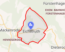 Location of Eichstruth | |
Eichstruth Eichstruth | |
| Coordinates: 51°18′18″N 10°4′54″E / 51.30500°N 10.08167°E / 51.30500; 10.08167 | |
| Country | Germany |
| State | Thuringia |
| District | Eichsfeld |
| Municipality | Uder |
| Area | |
• Total | 1.33 km2 (0.51 sq mi) |
| Elevation | 345 m (1,132 ft) |
| Population (2022-12-31) | |
• Total | 83 |
| • Density | 62/km2 (160/sq mi) |
| Time zone | UTC+01:00 (CET) |
| • Summer (DST) | UTC+02:00 (CEST) |
| Postal codes | 37318 |
| Dialling codes | 036087 |
Eichstruth (German pronunciation: [ˈaɪçstʁuːt]) is a village and a former municipality in the district of Eichsfeld in Thuringia, Germany. By area, it was the smallest municipality in what was East Germany. On 1 January 2024 it became part of the municipality Uder.1
References
References
- Thüringer Gesetz zur freiwilligen Neugliederung kreisangehöriger Gemeinden im Jahr 2024 Archived 2024-06-15 at the Wayback Machine, Gesetz- und Verordnungsblatt für den Freistaat Thüringen, 2023 Nr. 15, pp. 347-348